• Bine ati venit! Acesta este noul server al forumului Cutremur.net!

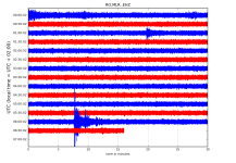
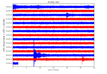
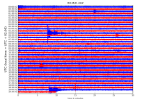
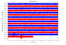
Seismograme teleseisme

Magnitude ML 4.1
Region WESTERN TURKEY
Date time 2021-01-19 00:41:08.1 UTC
Location 37.07 N ; 29.07 E
Depth 2 km
Distances 78 km S of Denizli, Turkey / pop: 313,000 / local time: 03:41:08.1 2021-01-19
37 km NE of Ortaca, Turkey / pop: 19,700 / local time: 03:41:08.1 2021-01-19

Magnitude Mw 6.4
Region SAN JUAN, ARGENTINA
Date time 2021-01-19 02:46:21.9 UTC
Location 31.83 S ; 68.77 W
Depth 20 km
Distances 39 km SSW of San Juan, Argentina / pop: 447,000 / local time: 23:46:21.9 2021-01-18
24 km SW of Pocito, Argentina / pop: 40,900 / local time: 23:46:21.9 2021-01-18
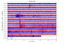
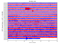
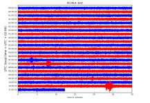
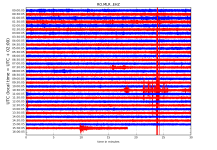
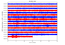
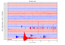
RO.VRI..EHZ.D.2021.019.png?1611036929792.png - Click image for larger version  Name:	RO.VRI..EHZ.D.2021.019.png?1611036929792.png Views:	28 Size:	226.4 KB ID:	12300


RO.VRI..EHZ.D.2021.019.png?1611036929792.png - Click image for larger version  Name:	RO.VRI..EHZ.D.2021.019.png?1611036929792.png Views:	28 Size:	226.4 KB ID:	12300

http://helitool.infp.ro/
 
Magnitude Mw 5.5
Region SEA OF OKHOTSK
Date time 2021-01-20 16:00:40.5 UTC
Location 49.72 N ; 147.76 E
Depth 574 km
Distances 482 km NE of Yuzhno-Sakhalinsk, Russia / pop: 176,000 / local time: 03:00:40.5 2021-01-21
342 km ENE of Poronaysk, Russia / pop: 16,600 / local time: 03:00:40.5 2021-01-21


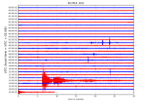
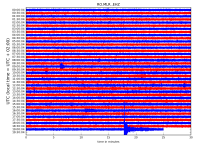
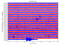
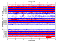
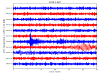
RO.MLR..EHZ.D.2021.020.png?1611151570504.png - Click image for larger version  Name:	RO.MLR..EHZ.D.2021.020.png?1611151570504.png Views:	0 Size:	308.5 KB ID:	12310

http://helitool.infp.ro/
 
Magnitude Mw 7.0
Region PHILIPPINE ISLANDS REGION
Date time 2021-01-21 12:23:04.9 UTC
Location 5.02 N ; 127.53 E
Depth 92 km
Distances 260 km SE of Mati, Philippines / pop: 105,000 / local time: 20:23:04.9 2021-01-21
211 km SE of Pondaguitan, Philippines / pop: 2,100 / local time: 20:23:04.9 2021-01-21


Magnitude mb 4.9
Region CYPRUS REGION
Date time 2021-01-21 14:27:06.0 UTC
Location 34.96 N ; 33.75 E
Depth 60 km
Distances 43 km ESE of Nicosia, Cyprus / pop: 200,000 / local time: 16:27:06.0 2021-01-21
12 km ENE of Larnaca, Cyprus / pop: 72,000 / local time: 16:27:06.0 2021-01-21

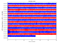
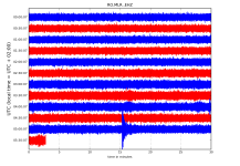
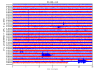
RO.MLR..EHZ.D.2021.021.png?1611239937851.png

http://helitool.infp.ro/
 
Magnitude ML 4.6
Region CRETE, GREECE
Date time 2021-01-22 06:57:27.9 UTC
Location 35.65 N ; 26.48 E
Depth 28 km
Distances 126 km ENE of Ir?kleion, Greece / pop: 137,000 / local time: 08:57:27.9 2021-01-22
60 km NNE of Sitia, Greece / pop: 8,700 / local time: 08:57:27.9 2021-01-22

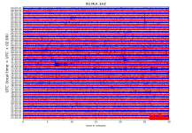
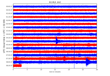
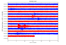
RO.MLR..EHZ.D.2021.022.png?1611293994848.png

http://helitool.infp.ro/
 
Magnitude Mw 6.9
Region SOUTH SHETLAND ISLANDS
Date time 2021-01-23 23:36:50.6 UTC
Location 61.81 S ; 55.38 W
Depth 10 km
Distances 1331 km ESE of Punta Arenas, Chile / pop: 117,000 / local time: 20:36:50.6 2021-01-23
1064 km ESE of Tolhuin, Argentina / pop: 3,000 / local time: 20:36:50.6 2021-01-23


Magnitude Mw 5.8
Region AUCKLAND ISLANDS, N.Z. REGION
Date time 2021-01-24 05:47:53.2 UTC
Location 51.15 S ; 162.09 E
Depth 10 km
Distances 853 km SW of Dunedin, New Zealand / pop: 114,000 / local time: 18:47:53.2 2021-01-24
681 km SSW of Bluff, New Zealand / pop: 1,900 / local time: 18:47:53.2 2021-01-24

RO.MLR..EHZ.D.2021.023.png?1611470775316.png - Click image for larger version  Name:	RO.MLR..EHZ.D.2021.023.png?1611470775316.png Views:	0 Size:	382.3 KB ID:	12329

RO.MLR..EHZ.D.2021.023.png?1611470775316.png - Click image for larger version  Name:	RO.MLR..EHZ.D.2021.023.png?1611470775316.png Views:	0 Size:	382.3 KB ID:	12329


Magnitude mb 4.9
Region FIJI REGION
Date time 2021-01-24 06:36:29.6 UTC
Location 17.75 S ; 177.38 W
Depth 349 km
Distances 441 km NW of Nuku?alofa, Tonga / pop: 22,400 / local time: 19:36:29.6 2021-01-24
351 km ENE of Levuka, Fiji / pop: 8,300 / local time: 18:36:29.6 2021-01-24

RO.MLR..EHZ.D.2021.024.png?1611470546837.png - Click image for larger version  Name:	RO.MLR..EHZ.D.2021.024.png?1611470546837.png Views:	0 Size:	201.3 KB ID:	12330

http://helitool.infp.ro/
 
Magnitude mb 5.2
Region TAJIKISTAN
Date time 2021-01-24 19:01:21.8 UTC
Location 37.11 N ; 71.70 E
Depth 109 km
Distances 256 km ENE of Kunduz, Afghanistan / pop: 161,000 / local time: 23:31:21.8 2021-01-24
44 km SSE of Khorugh, Tajikistan / pop: 30,000 / local time: 00:01:21.8 2021-01-25


RO.MLR..EHZ.D.2021.024.png?1611470546837.png - Click image for larger version  Name:	RO.MLR..EHZ.D.2021.024.png?1611470546837.png Views:	0 Size:	347.7 KB ID:	12340


http://helitool.infp.ro/
 
Magnitude Mw 5.2
Region SOUTHWESTERN RYUKYU ISL., JAPAN
Date time 2021-01-25 07:25:36.2 UTC
Location 23.55 N ; 123.63 E
Depth 10 km
Distances 212 km E of Hualien City, Taiwan / pop: 350,000 / local time: 15:25:36.2 2021-01-25
103 km SSW of Ishigaki, Japan / pop: 44,800 / local time: 16:25:36.2 2021-01-25

RO.MLR..EHZ.D.2021.025.png?1611552496088.png - Click image for larger version  Name:	RO.MLR..EHZ.D.2021.025.png?1611552496088.png Views:	0 Size:	232.7 KB ID:	12342


Magnitude ML 3.4
Region SERBIA
Date time 2021-01-25 10:51:48.8 UTC
Location 43.92 N ; 20.86 E
Depth 2 km
Distances 103 km SSE of Belgrade, Serbia / pop: 1,273,000 / local time: 11:51:48.8 2021-01-25
12 km SSW of Kragujevac, Serbia / pop: 147,000 / local time: 11:51:48.8 2021-01-25


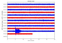
RO.MLR..EHZ.D.2021.025.png?1611552496088.png - Click image for larger version  Name:	RO.MLR..EHZ.D.2021.025.png?1611552496088.png Views:	0 Size:	271.3 KB ID:	12348

http://helitool.infp.ro/
 
Magnitude Mw 5.7
Region GUYANA
Date time 2021-01-31 19:05:15.1 UTC
Location 2.72 N ; 59.66 W
Depth 10 km
Distances 484 km S of Georgetown, Guyana / pop: 235,000 / local time: 15:05:15.1 2021-01-31
113 km E of Boa Vista, Brazil / pop: 235,000 / local time: 15:05:15.1 2021-01-31

RO.MLR..EHZ.D.2021.031.png?1612074880551.png - Click image for larger version  Name:	RO.MLR..EHZ.D.2021.031.png?1612074880551.png Views:	0 Size:	348.2 KB ID:	12387


http://helitool.infp.ro/
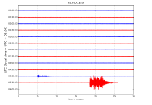
 
Magnitude ML 3.9
Region NEAR THE COAST OF WESTERN TURKEY
Date time 2021-02-01 05:03:24.2 UTC
Location 38.96 N ; 26.06 E
Depth 10 km
Distances 112 km WNW of ?zmir, Turkey / pop: 2,500,000 / local time: 08:03:24.2 2021-02-01
17 km SSW of Polichn?tos, Greece / pop: 2,600 / local time: 07:03:24.2 2021-02-01


RO.MLR..EHZ.D.2021.032.png?1612157912189.png - Click image for larger version  Name:	RO.MLR..EHZ.D.2021.032.png?1612157912189.png Views:	0 Size:	169.6 KB ID:	12390


Magnitude mb 4.8
Region NEAR THE COAST OF WESTERN TURKEY
Date time 2021-02-01 05:46:52.4 UTC
Location 38.96 N ; 26.05 E
Depth 10 km
Distances 112 km WNW of ?zmir, Turkey / pop: 2,500,000 / local time: 08:46:52.4 2021-02-01
17 km SSW of Polichn?tos, Greece / pop: 2,600 / local time: 07:46:52.4 2021-02-01


Magnitude Mw 4.8
Region NEAR THE COAST OF WESTERN TURKEY
Date time 2021-02-01 05:47:53.8 UTC
Location 38.96 N ; 26.00 E
Depth 1 km
Distances 116 km WNW of ?zmir, Turkey / pop: 2,500,000 / local time: 08:47:53.8 2021-02-01
21 km SW of Polichn?tos, Greece / pop: 2,600 / local time: 07:47:53.8 2021-02-01

RO.MLR..EHZ.D.2021.032.png?1612157912189.png - Click image for larger version  Name:	RO.MLR..EHZ.D.2021.032.png?1612157912189.png Views:	0 Size:	101.8 KB ID:	12392

RO.VRI..EHZ.D.2021.032.png?1612157917682.png - Click image for larger version  Name:	RO.VRI..EHZ.D.2021.032.png?1612157917682.png Views:	0 Size:	112.8 KB ID:	12393

http://helitool.infp.ro/
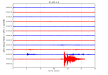
 
Magnitude mb 4.8
Region NEAR THE COAST OF WESTERN TURKEY
Date time 2021-02-01 06:00:04.7 UTC
Location 38.94 N ; 26.07 E
Depth 16 km
Distances 110 km WNW of ?zmir, Turkey / pop: 2,500,000 / local time: 09:00:04.7 2021-02-01
26 km WSW of Plom?ri, Greece / pop: 2,900 / local time: 08:00:04.7 2021-02-01


RO.MLR..EHZ.D.2021.032.png?1612157912189.png - Click image for larger version  Name:	RO.MLR..EHZ.D.2021.032.png?1612157912189.png Views:	0 Size:	106.6 KB ID:	12395


Magnitude ML 4.0
Region NEAR THE COAST OF WESTERN TURKEY
Date time 2021-02-01 06:34:11.0 UTC
Location 38.94 N ; 26.09 E
Depth 11 km
Distances 108 km WNW of ?zmir, Turkey / pop: 2,500,000 / local time: 09:34:11.0 2021-02-01
25 km WSW of Plom?ri, Greece / pop: 2,900 / local time: 08:34:11.0 2021-02-01

RO.MLR..EHZ.D.2021.032.png?1612157912189.png - Click image for larger version  Name:	RO.MLR..EHZ.D.2021.032.png?1612157912189.png Views:	0 Size:	112.2 KB ID:	12396

http://helitool.infp.ro/
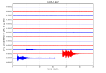
 
Magnitude mb 5.1
Region NEAR THE COAST OF WESTERN TURKEY
Date time 2021-02-01 08:35:17.4 UTC
Location 38.96 N ; 26.08 E
Depth 10 km
Distances 110 km WNW of ?zmir, Turkey / pop: 2,500,000 / local time: Europe/Istanbul
25 km WSW of Plom?ri, Greece / pop: 2,900 / local time: Europe/Athens

RO.VRI..EHZ.D.2021.032.png?1612157917682.png - Click image for larger version  Name:	RO.VRI..EHZ.D.2021.032.png?1612157917682.png Views:	0 Size:	136.2 KB ID:	12399

RO.VRI..EHZ.D.2021.032.png?1612157917682.png - Click image for larger version  Name:	RO.VRI..EHZ.D.2021.032.png?1612157917682.png Views:	0 Size:	136.4 KB ID:	12402

RO.VRI..EHZ.D.2021.032.png?1612157917682.png - Click image for larger version  Name:	RO.VRI..EHZ.D.2021.032.png?1612157917682.png Views:	0 Size:	136.4 KB ID:	12402

RO.VRI..EHZ.D.2021.032.png?1612157917682.png - Click image for larger version  Name:	RO.VRI..EHZ.D.2021.032.png?1612157917682.png Views:	0 Size:	136.4 KB ID:	12402
http://helitool.infp.ro/
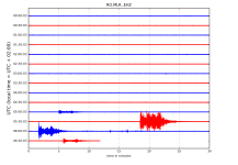
 
Magnitude mb 4.7
Region NEAR THE COAST OF WESTERN TURKEY
Date time 2021-02-01 13:10:15.5 UTC
Location 38.95 N ; 26.04 E
Depth 10 km
Distances 113 km WNW of ?zmir, Turkey / pop: 2,500,000 / local time: 16:10:15.5 2021-02-01
29 km WSW of Plom?ri, Greece / pop: 2,900 / local time: 15:10:15.5 2021-02-01

RO.MLR..EHZ.D.2021.032.png?1612157912189.png - Click image for larger version  Name:	RO.MLR..EHZ.D.2021.032.png?1612157912189.png Views:	0 Size:	156.2 KB ID:	12404

RO.VRI..EHZ.D.2021.032.png?1612157917682.png - Click image for larger version  Name:	RO.VRI..EHZ.D.2021.032.png?1612157917682.png Views:	0 Size:	172.7 KB ID:	12405

http://helitool.infp.ro/
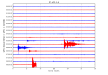
 
Magnitude Mw 4.6
Region NEAR THE COAST OF WESTERN TURKEY
Date time 2021-02-01 20:46:16.0 UTC
Location 38.99 N ; 26.12 E
Depth 17 km
Distances 109 km WNW of ?zmir, Turkey / pop: 2,500,000 / local time: 23:46:16.0 2021-02-01
11 km SSW of Polichn?tos, Greece / pop: 2,600 / local time: 22:46:16.0 2021-02-01

RO.MLR..EHZ.D.2021.032.png?1612157912189.png - Click image for larger version  Name:	RO.MLR..EHZ.D.2021.032.png?1612157912189.png Views:	0 Size:	211.9 KB ID:	12408

RO.VRI..EHZ.D.2021.032.png?1612157917682.png - Click image for larger version  Name:	RO.VRI..EHZ.D.2021.032.png?1612157917682.png Views:	0 Size:	229.8 KB ID:	12409


http://helitool.infp.ro/
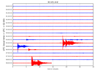
 
Magnitude Mw 4.5
Region CENTRAL TURKEY
Date time 2021-02-02 00:02:43.7 UTC
Location 39.10 N ; 36.10 E
Depth 5 km
Distances 67 km NE of Kayseri, Turkey / pop: 592,000 / local time: 03:02:43.7 2021-02-02
10 km SSE of Gemerek, Turkey / pop: 16,900 / local time: 03:02:43.7 2021-02-02


Magnitude Mw 5.2
Region WESTERN XIZANG
Date time 2021-02-02 02:31:15.0 UTC
Location 28.86 N ; 87.59 E
Depth 10 km
Distances 214 km NNW of D?rjiling, India / pop: 123,000 / local time: 08:01:15.0 2021-02-02
133 km WSW of Rikaze, China / pop: 80,000 / local time: 10:31:15.0 2021-02-02

RO.MLR..EHZ.D.2021.033.png?1612244169300.png - Click image for larger version  Name:	RO.MLR..EHZ.D.2021.033.png?1612244169300.png Views:	0 Size:	172.1 KB ID:	12412

http://helitool.infp.ro/
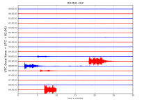
 
Magnitude mb 5.1
Region WESTERN XIZANG
Date time 2021-02-04 05:06:24.0 UTC
Location 28.80 N ; 87.41 E
Depth 10 km
Distances 214 km NW of D?rjiling, India / pop: 123,000 / local time: 10:36:24.0 2021-02-04
111 km NNE of Lobujya, Nepal / pop: 8,700 / local time: 10:51:24.0 2021-02-04

RO.MLR..EHZ.D.2021.035.png?1612416426599.png - Click image for larger version  Name:	RO.MLR..EHZ.D.2021.035.png?1612416426599.png Views:	0 Size:	192.6 KB ID:	12462


Magnitude Mw 5.4
Region TAIWAN REGION
Date time 2021-02-04 08:14:03.0 UTC
Location 21.58 N ; 121.99 E
Depth 10 km
Distances 157 km SE of Taitung City, Taiwan / pop: 109,000 / local time: 16:14:03.0 2021-02-04
126 km N of Basco, Philippines / pop: 7,200 / local time: 16:14:03.0 2021-02-04

RO.MLR..EHZ.D.2021.035.png?1612416426599.png - Click image for larger version  Name:	RO.MLR..EHZ.D.2021.035.png?1612416426599.png Views:	0 Size:	220.9 KB ID:	12465

http://helitool.infp.ro/
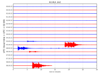
 
Magnitude Mw 5.1
Region ARMENIA
Date time 2021-02-05 15:36:10.7 UTC
Location 40.51 N ; 45.29 E
Depth 10 km
Distances 75 km ESE of Vanadzor, Armenia / pop: 101,000 / local time: 19:36:10.7 2021-02-05
11 km SSW of Chambarak, Armenia / pop: 6,100 / local time: 19:36:10.7 2021-02-05

RO.MLR..EHZ.D.2021.036.png?1612502689991.png - Click image for larger version  Name:	RO.MLR..EHZ.D.2021.036.png?1612502689991.png Views:	0 Size:	302.2 KB ID:	12471


http://helitool.infp.ro/
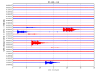
 
Magnitude ML 4.1
Region NEAR THE COAST OF WESTERN TURKEY
Date time 2021-02-06 16:09:15.5 UTC
Location 38.94 N ; 26.07 E
Depth 8 km
Distances 110 km WNW of ?zmir, Turkey / pop: 2,500,000 / local time: 19:09:15.5 2021-02-06
26 km WSW of Plom?ri, Greece / pop: 2,900 / local time: 18:09:15.5 2021-02-06

RO.MLR..EHZ.D.2021.037.png?1612593051278.png - Click image for larger version  Name:	RO.MLR..EHZ.D.2021.037.png?1612593051278.png Views:	0 Size:	300.7 KB ID:	12479


Magnitude ML 4.1
Region NEAR THE COAST OF WESTERN TURKEY
Date time 2021-02-06 18:22:48.3 UTC
Location 38.94 N ; 26.12 E
Depth 11 km
Distances 106 km WNW of ?zmir, Turkey / pop: 2,500,000 / local time: 21:22:48.3 2021-02-06
22 km WSW of Plom?ri, Greece / pop: 2,900 / local time: 20:22:48.3 2021-02-06

RO.MLR..EHZ.D.2021.037.png?1612593051278.png - Click image for larger version  Name:	RO.MLR..EHZ.D.2021.037.png?1612593051278.png Views:	0 Size:	306.4 KB ID:	12480

http://helitool.infp.ro/
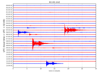
 
Magnitude Mw 6.0
Region MINDANAO, PHILIPPINES
Date time 2021-02-07 04:22:56.9 UTC
Location 6.78 N ; 125.17 E
Depth 22 km
Distances 21 km W of Digos, Philippines / pop: 116,000 / local time: 12:22:56.9 2021-02-07
5 km WSW of Bansalan, Philippines / pop: 21,300 / local time: 12:22:56.9 2021-02-07


RO.MLR..EHZ.D.2021.038.png?1612680007973.png - Click image for larger version  Name:	RO.MLR..EHZ.D.2021.038.png?1612680007973.png Views:	0 Size:	191.1 KB ID:	12483


http://helitool.infp.ro/
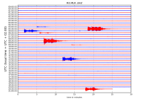
 
Magnitude ML 4.1
Region DODECANESE ISLANDS, GREECE
Date time 2021-02-09 07:30:34.7 UTC
Location 37.79 N ; 26.40 E
Depth 9 km
Distances 91 km SW of Karaba?lar, Turkey / pop: 458,000 / local time: 10:30:34.7 2021-02-09
27 km WSW of N?on Karlov?sion, Greece / pop: 6,700 / local time: 09:30:34.7 2021-02-09

RO.MLR..EHZ.D.2021.040.png?1612848430245.png - Click image for larger version  Name:	RO.MLR..EHZ.D.2021.040.png?1612848430245.png Views:	0 Size:	219.4 KB ID:	12500


Magnitude ML 4.6
Region WESTERN TURKEY
Date time 2021-02-09 15:51:54.2 UTC
Location 38.60 N ; 31.63 E
Depth 7 km
Distances 96 km E of Afyonkarahisar, Turkey / pop: 146,000 / local time: 18:51:54.2 2021-02-09
14 km N of Tuzluk?u, Turkey / pop: 6,000 / local time: 18:51:54.2 2021-02-09

Magnitude ML 4.2
Region WESTERN TURKEY
Date time 2021-02-09 15:53:57.3 UTC
Location 38.59 N ; 31.65 E
Depth 5 km
Distances 98 km E of Afyonkarahisar, Turkey / pop: 146,000 / local time: 18:53:57.3 2021-02-09
13 km N of Tuzluk?u, Turkey / pop: 6,000 / local time: 18:53:57.3 2021-02-09

RO.MLR..EHZ.D.2021.040.png?1612848430245.png - Click image for larger version  Name:	RO.MLR..EHZ.D.2021.040.png?1612848430245.png Views:	0 Size:	288.6 KB ID:	12505

http://helitool.infp.ro/
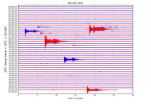
 
Magnitude Mw 6.0
Region SOUTHEAST OF LOYALTY ISLANDS
Date time 2021-02-10 12:24:21.6 UTC
Location 22.84 S ; 171.71 E
Depth 10 km
Distances 544 km E of Noum?a, New Caledonia / pop: 93,000 / local time: 23:24:21.6 2021-02-10
420 km E of Tadine, New Caledonia / pop: 7,400 / local time: 23:24:21.6 2021-02-10


Magnitude Mw 5.7
Region SOUTHEAST OF LOYALTY ISLANDS
Date time 2021-02-10 12:32:10.8 UTC
Location 22.63 S ; 171.64 E
Depth 10 km
Distances 535 km E of Noum?a, New Caledonia / pop: 93,000 / local time: 23:32:10.8 2021-02-10
406 km E of Tadine, New Caledonia / pop: 7,400 / local time: 23:32:10.8 2021-02-10

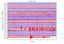
RO.MLR..EHZ.D.2021.041.png?1612935356989.png - Click image for larger version  Name:	RO.MLR..EHZ.D.2021.041.png?1612935356989.png Views:	0 Size:	242.0 KB ID:	12513


Magnitude Mw 6.2
Region SOUTHWEST OF SUMATRA, INDONESIA
Date time 2021-02-10 12:52:28.5 UTC
Location 5.62 S ; 101.73 E
Depth 10 km
Distances 392 km WSW of Bandar Lampung, Indonesia / pop: 800,000 / local time: 19:52:28.5 2021-02-10
211 km S of Bengkulu, Indonesia / pop: 309,000 / local time: 19:52:28.5 2021-02-10

RO.MLR..EHZ.D.2021.041.png?1612935356989.png - Click image for larger version  Name:	RO.MLR..EHZ.D.2021.041.png?1612935356989.png Views:	0 Size:	236.2 KB ID:	12514


Magnitude Mw 6.1
Region SOUTHEAST OF LOYALTY ISLANDS
Date time 2021-02-10 13:01:59.8 UTC
Location 22.78 S ; 171.58 E
Depth 10 km
Distances 530 km E of Noum?a, New Caledonia / pop: 93,000 / local time: 00:01:59.8 2021-02-11
405 km E of Tadine, New Caledonia / pop: 7,400 / local time: 00:01:59.8 2021-02-11


Magnitude Mw 7.7
Region SOUTHEAST OF LOYALTY ISLANDS
Date time 2021-02-10 13:19:59.6 UTC
Location 23.25 S ; 171.49 E
Depth 10 km
Distances 528 km E of Noum?a, New Caledonia / pop: 93,000 / local time: 00:19:59.6 2021-02-11
417 km ESE of Tadine, New Caledonia / pop: 7,400 / local time: 00:19:59.6 2021-02-11

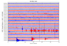
RO.MLR..EHZ.D.2021.041.png?1612935356989.png - Click image for larger version  Name:	RO.MLR..EHZ.D.2021.041.png?1612935356989.png Views:	0 Size:	214.9 KB ID:	12515

http://helitool.infp.ro/
 
Back
Sus