• Bine ati venit! Acesta este noul server al forumului Cutremur.net!

Seismograme teleseisme

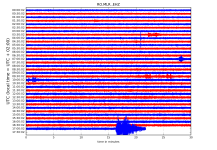
Magnitude ML 3.5
Region GREECE
Date time 2019-02-09 20:59:17.7 UTC
Location 41.27 N ; 24.70 E
Depth 2 km
Distances 195 km SE of Sofia, Bulgaria / pop: 1,153,000 / local time: 22:59:17.7 2019-02-09
35 km S of Smolyan, Bulgaria / pop: 32,100 / local time: 22:59:17.7 2019-02-09
21 km NW of X?nthi, Greece / pop: 48,300 / local time: 22:59:17.7 2019-02-09
4 km NW of Kallith?a, Greece / pop: 1,200 / local time: 22:59:17.7 2019-02-09
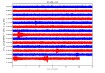
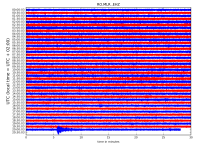
RO.MLR..EHZ.D.2019.040.png?1549730736914.png - Click image for larger version  Name:	RO.MLR..EHZ.D.2019.040.png?1549730736914.png Views:	1 Size:	348.6 KB ID:	4839


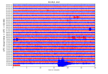
Magnitude mb 4.8
Region WESTERN IRAN
Date time 2019-02-09 21:26:21.8 UTC
Location 31.67 N ; 49.58 E
Depth 10 km
Distances 212 km NE of Al Ba?rah, Iraq / pop: 2,600,000 / local time: 00:26:21.8 2019-02-10
95 km NE of Ahv?z, Iran, Islamic Republic of / pop: 842,000 / local time: 00:56:21.8 2019-02-10
39 km SE of Masjed Soleym?n, Iran, Islamic Republic of / pop: 112,000 / local time: 00:56:21.8 2019-02-10
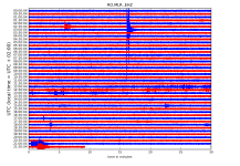
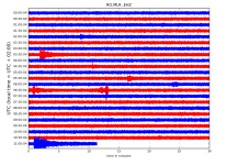
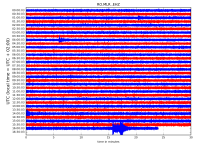
RO.MLR..EHZ.D.2019.040.png?1549730736914.png - Click image for larger version  Name:	RO.MLR..EHZ.D.2019.040.png?1549730736914.png Views:	1 Size:	348.5 KB ID:	4840

http://helitool.infp.ro/
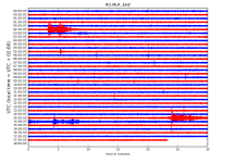
 
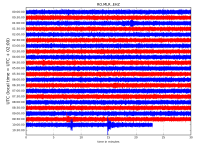
Magnitude mb 5.2
Region MYANMAR-INDIA BORDER REGION
Date time 2019-02-10 03:22:09.0 UTC
Location 27.36 N ; 96.52 E
Depth 40 km
Distances 371 km W of Dayan, China / pop: 1,138,000 / local time: 11:22:09.0 2019-02-10
236 km N of Myitkyin?, Myanmar / pop: 90,900 / local time: 09:52:09.0 2019-02-10
71 km SE of Tezu, India / pop: 15,000 / local time: 08:52:09.0 2019-02-10

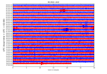
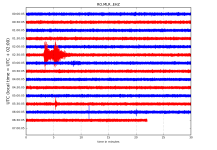
RO.MLR..EHZ.D.2019.041.png?1549781644579.png - Click image for larger version  Name:	RO.MLR..EHZ.D.2019.041.png?1549781644579.png Views:	1 Size:	201.0 KB ID:	4844

http://helitool.infp.ro/
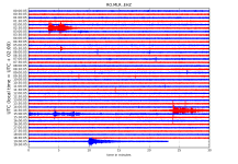
 
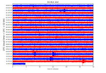
Magnitude Mw 5.3
Region SOUTHERN IRAN
Date time 2019-02-10 10:54:48.0 UTC
Location 27.03 N ; 55.66 E
Depth 10 km
Distances 199 km N of Dubai, United Arab Emirates / pop: 1,138,000 / local time: 14:54:48.0 2019-02-10
64 km W of Bandar ?Abb?s, Iran, Islamic Republic of / pop: 353,000 / local time: 14:24:48.0 2019-02-10

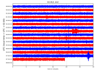
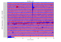
RO.MLR..EHZ.D.2019.041.png?1549781644579.png - Click image for larger version  Name:	RO.MLR..EHZ.D.2019.041.png?1549781644579.png Views:	1 Size:	245.1 KB ID:	4846


http://helitool.infp.ro/
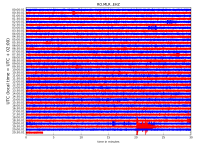
 
Magnitude mb 4.1
Region DODECANESE IS.-TURKEY BORDER REG
Date time 2019-02-11 16:38:03.7 UTC
Location 36.45 N ; 28.87 E
Depth 10 km
Distances 266 km SE of ?zmir, Turkey / pop: 2,501,000 / local time: 19:38:03.7 2019-02-11
96 km SE of Mu?la, Turkey / pop: 48,200 / local time: 19:38:03.7 2019-02-11
58 km E of R?dos, Greece / pop: 56,200 / local time: 18:38:03.7 2019-02-11
28 km SW of ?l?deniz, Turkey / pop: 2,800 / local time: 19:38:03.7 2019-02-11


RO.MLR..EHZ.D.2019.042.png?1549897137523.png - Click image for larger version  Name:	RO.MLR..EHZ.D.2019.042.png?1549897137523.png Views:	1 Size:	311.5 KB ID:	4855

http://helitool.infp.ro/
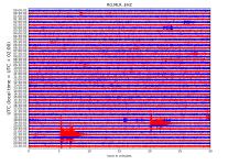
 
Magnitude ML 3.1
Region AEGEAN SEA
Date time 2019-02-12 03:50:53.1 UTC
Location 40.79 N ; 25.39 E
Depth 5 km
Distances 273 km SE of Sofia, Bulgaria / pop: 1,153,000 / local time: 05:50:53.1 2019-02-12
37 km S of Komotin?, Greece / pop: 45,700 / local time: 05:50:53.1 2019-02-12
22 km S of Xilagan?, Greece / pop: 1,500 / local time: 05:50:53.1 2019-02-12

RO.MLR..EHZ.D.2019.043.png?1549949969319.png - Click image for larger version  Name:	RO.MLR..EHZ.D.2019.043.png?1549949969319.png Views:	1 Size:	232.5 KB ID:	4857

http://helitool.infp.ro/
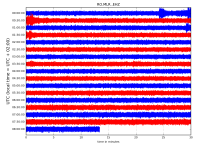
 
Magnitude Mw 4.8
Region CENTRAL TURKEY
Date time 2019-02-12 17:14:31.2 UTC
Location 40.57 N ; 33.03 E
Depth 7 km
Distances 74 km N of Ankara, Turkey / pop: 3,518,000 / local time: 20:14:31.2 2019-02-12
50 km W of Khanjarah, Turkey / pop: 71,400 / local time: 20:14:31.2 2019-02-12
9 km SW of Orta, Turkey / pop: 6,100 / local time: 20:14:31.2 2019-02-12

RO.MLR..EHZ.D.2019.043.png?1549981757424.png - Click image for larger version  Name:	RO.MLR..EHZ.D.2019.043.png?1549981757424.png Views:	1 Size:	314.7 KB ID:	4867

RO.MLR..EHZ.D.2019.043.png?1549981757424.png - Click image for larger version  Name:	RO.MLR..EHZ.D.2019.043.png?1549981757424.png Views:	1 Size:	319.6 KB ID:	4868


http://helitool.infp.ro/
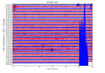
 
Magnitude Mw 5.0
Region KURIL ISLANDS
Date time 2019-02-13 10:02:55.4 UTC
Location 45.32 N ; 151.43 E
Depth 50 km
Distances 844 km E of Sapporo-shi, Japan / pop: 1,884,000 / local time: 19:02:55.4 2019-02-13
696 km E of Yuzhno-Sakhalinsk, Russian Federation / pop: 177,000 / local time: 21:02:55.4 2019-02-13
278 km E of Kuril'sk, Russian Federation / pop: 1,800 / local time: 21:02:55.4 2019-02-13

RO.MLR..EHZ.D.2019.044.png?1550036531075.png

http://helitool.infp.ro/
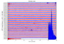
 
Magnitude mb 5.1
Region KURIL ISLANDS
Date time 2019-02-13 11:44:01.4 UTC
Location 45.43 N ; 151.39 E
Depth 30 km
Distances 843 km E of Sapporo-shi, Japan / pop: 1,884,000 / local time: 20:44:01.4 2019-02-13
689 km E of Yuzhno-Sakhalinsk, Russian Federation / pop: 177,000 / local time: 22:44:01.4 2019-02-13
276 km E of Kuril'sk, Russian Federation / pop: 1,800 / local time: 22:44:01.4 2019-02-13


RO.MLR..EHZ.D.2019.044.png?1550036531075.png - Click image for larger version  Name:	RO.MLR..EHZ.D.2019.044.png?1550036531075.png Views:	1 Size:	285.6 KB ID:	4881

http://helitool.infp.ro/
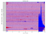
 
Magnitude Mw 6.1
Region NORTHERN MID-ATLANTIC RIDGE
Date time 2019-02-14 19:57:06.3 UTC
Location 35.41 N ; 36.28 W
Depth 10 km
Distances 2083 km SE of Saint-Pierre, Saint Pierre and Miquelon / pop: 6,200 / local time: 16:57:06.3 2019-02-14
984 km W of Ponta Delgada, Portugal / pop: 20,100 / local time: 18:57:06.3 2019-02-14

RO.MLR..EHZ.D.2019.045.png?1550158143056.png - Click image for larger version  Name:	RO.MLR..EHZ.D.2019.045.png?1550158143056.png Views:	1 Size:	364.6 KB ID:	4904

http://helitool.infp.ro/
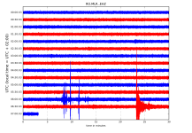
 
Magnitude ML 4.0
Region WESTERN TURKEY
Date time 2019-02-15 16:14:28.0 UTC
Location 40.80 N ; 27.91 E
Depth 9 km
Distances 91 km W of ?stanbul, Turkey / pop: 11,175,000 / local time: 19:14:28.0 2019-02-15
39 km SE of Tekirda?, Turkey / pop: 123,000 / local time: 19:14:28.0 2019-02-15
19 km S of Marmaraere?lisi, Turkey / pop: 11,000 / local time: 19:14:28.0 2019-02-15

RO.MLR..EHZ.D.2019.046.png?1550242783606.png - Click image for larger version  Name:	RO.MLR..EHZ.D.2019.046.png?1550242783606.png Views:	1 Size:	334.4 KB ID:	4909

http://helitool.infp.ro/
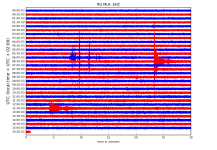
 
Magnitude ML 4.0
Region AEGEAN SEA
Date time 2019-02-17 02:31:44.8 UTC
Location 39.61 N ; 23.28 E
Depth 2 km
Distances 185 km N of Athens, Greece / pop: 730,000 / local time: 04:31:44.8 2019-02-17
74 km E of L?risa, Greece / pop: 129,000 / local time: 04:31:44.8 2019-02-17
39 km NE of V?los, Greece / pop: 84,500 / local time: 04:31:44.8 2019-02-17
24 km NE of Zagor?, Greece / pop: 2,400 / local time: 04:31:44.8 2019-02-17


RO.MLR..EHZ.D.2019.048.png?1550386284989.png - Click image for larger version  Name:	RO.MLR..EHZ.D.2019.048.png?1550386284989.png Views:	1 Size:	173.2 KB ID:	4919


http://helitool.infp.ro/
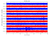
 
Magnitude Mw 6.5
Region NEW IRELAND REGION, P.N.G.
Date time 2019-02-17 14:35:56.2 UTC
Location 3.40 S ; 152.14 E
Depth 371 km
Distances 865 km NE of Port Moresby, Papua New Guinea / pop: 284,000 / local time: 00:35:56.2 2019-02-18
106 km N of Kokopo, Papua New Guinea / pop: 26,300 / local time: 00:35:56.2 2019-02-18
44 km NW of Namatanai, Papua New Guinea / pop: 1,400 / local time: 00:35:56.2 2019-02-18


RO.MLR..EHZ.D.2019.048.png?1550386284989.png


http://helitool.infp.ro/
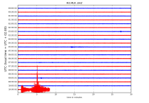
 
Magnitude Mw 4.8
Region SOUTHERN GREECE
Date time 2019-02-17 19:07:43.2 UTC
Location 36.45 N ; 22.95 E
Depth 10 km
Distances 183 km S of Athens, Greece / pop: 730,000 / local time: 21:07:43.2 2019-02-17
128 km SE of Tr?poli, Greece / pop: 26,600 / local time: 21:07:43.2 2019-02-17
83 km SE of Sparta, Greece / pop: 15,500 / local time: 21:07:43.2 2019-02-17
27 km S of G?fyra, Greece / pop: 1,500 / local time: 21:07:43.2 2019-02-17

RO.MLR..EHZ.D.2019.048.png?1550386284989.png - Click image for larger version  Name:	RO.MLR..EHZ.D.2019.048.png?1550386284989.png Views:	1 Size:	302.8 KB ID:	4930


http://helitool.infp.ro/
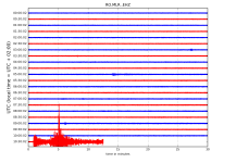
 
Magnitude ML 4.1
Region WESTERN TURKEY
Date time 2019-02-19 19:48:43.1 UTC
Location 40.39 N ; 27.15 E
Depth 11 km
Distances 164 km W of Bursa, Turkey / pop: 1,413,000 / local time: 22:48:43.1 2019-02-19
69 km NE of ?anakkale, Turkey / pop: 87,800 / local time: 22:48:43.1 2019-02-19
20 km NW of Biga, Turkey / pop: 30,900 / local time: 22:48:43.1 2019-02-19

RO.MLR..EHZ.D.2019.050.png?1550585923709.png - Click image for larger version  Name:	RO.MLR..EHZ.D.2019.050.png?1550585923709.png Views:	1 Size:	358.7 KB ID:	4953

Magnitude mb 4.1
Region WESTERN TURKEY
Date time 2019-02-19 21:33:55.5 UTC
Location 40.35 N ; 27.12 E
Depth 7 km
Distances 166 km W of Bursa, Turkey / pop: 1,413,000 / local time: 00:33:55.5 2019-02-20
65 km E of ?anakkale, Turkey / pop: 87,800 / local time: 00:33:55.5 2019-02-20
17 km NW of Biga, Turkey / pop: 30,900 / local time: 00:33:55.5 2019-02-20

RO.MLR..EHZ.D.2019.050.png?1550648223839.png


http://helitool.infp.ro/
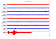
 
Magnitude Mw 5.6
Region MOLUCCA SEA
Date time 2019-02-20 00:10:40.7 UTC
Location 0.74 N ; 126.22 E
Depth 45 km
Distances 704 km S of Davao, Philippines / pop: 1,213,000 / local time: 08:10:40.7 2019-02-20
174 km SE of Manado, Indonesia / pop: 452,000 / local time: 08:10:40.7 2019-02-20
132 km W of Ternate, Indonesia / pop: 102,000 / local time: 09:10:40.7 2019-02-20

Magnitude ML 3.6
Region WESTERN TURKEY
Date time 2019-02-20 00:27:57.4 UTC
Location 40.37 N ; 27.16 E
Depth 7 km
Distances 163 km W of Bursa, Turkey / pop: 1,413,000 / local time: 03:27:57.4 2019-02-20
69 km E of ?anakkale, Turkey / pop: 87,800 / local time: 03:27:57.4 2019-02-20
17 km NW of Biga, Turkey / pop: 30,900 / local time: 03:27:57.4 2019-02-20

Magnitude ML 3.4
Region WESTERN TURKEY
Date time 2019-02-20 01:27:41.8 UTC
Location 40.39 N ; 27.14 E
Depth 6 km
Distances 165 km W of Bursa, Turkey / pop: 1,413,000 / local time: 04:27:41.8 2019-02-20
68 km NE of ?anakkale, Turkey / pop: 87,800 / local time: 04:27:41.8 2019-02-20
20 km NW of Biga, Turkey / pop: 30,900 / local time: 04:27:41.8 2019-02-20

RO.MLR..EHZ.D.2019.051.png?1550648223839.png

http://helitool.infp.ro/
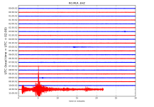
 
Magnitude mb 5.1
Region NEAR THE COAST OF WESTERN TURKEY
Date time 2019-02-20 18:23:28.1 UTC
Location 39.63 N ; 26.45 E
Depth 8 km
Distances 148 km NW of ?zmir, Turkey / pop: 2,501,000 / local time: 21:23:28.1 2019-02-20
57 km S of ?anakkale, Turkey / pop: 87,800 / local time: 21:23:28.1 2019-02-20
5 km NE of Ayvac?k, Turkey / pop: 6,900 / local time: 21:23:28.1 2019-02-20

RO.MLR..EHZ.D.2019.051.png?1550673754939.png - Click image for larger version  Name:	RO.MLR..EHZ.D.2019.051.png?1550673754939.png Views:	1 Size:	307.9 KB ID:	4964


RO.MLR..EHZ.D.2019.051.png?1550673754939.png - Click image for larger version  Name:	RO.MLR..EHZ.D.2019.051.png?1550673754939.png Views:	1 Size:	273.8 KB ID:	4965
RO.MLR..EHZ.D.2019.051.png?1550673754939.png - Click image for larger version  Name:	RO.MLR..EHZ.D.2019.051.png?1550673754939.png Views:	1 Size:	305.2 KB ID:	4967


http://helitool.infp.ro/
 
Magnitude Mw 5.6
Region FIJI REGION
Date time 2019-02-21 06:34:38.6 UTC
Location 20.95 S ; 178.80 W
Depth 611 km
Distances 375 km W of Nuku?alofa, Tonga / pop: 22,400 / local time: 19:34:38.6 2019-02-21
425 km SE of Suva, Fiji / pop: 77,400 / local time: 18:34:38.6 2019-02-21
1085 km SW of Apia, Samoa / pop: 40,500 / local time: 20:34:38.6 2019-02-21

RO.MLR..EHZ.D.2019.052.png?1550728182757.png - Click image for larger version  Name:	RO.MLR..EHZ.D.2019.052.png?1550728182757.png Views:	1 Size:	179.2 KB ID:	4970

http://helitool.infp.ro/
 
Magnitude Mw 5.5
Region HOKKAIDO, JAPAN REGION
Date time 2019-02-21 12:22:41.5 UTC
Location 42.86 N ; 141.95 E
Depth 40 km
Distances 54 km SE of Sapporo-shi, Japan / pop: 1,884,000 / local time: 21:22:41.5 2019-02-21
25 km E of Chitose, Japan / pop: 93,000 / local time: 21:22:41.5 2019-02-21


RO.MLR..EHZ.D.2019.052.png?1550762902827.png

http://helitool.infp.ro/
 
Magnitude ML 3.7
Region AEGEAN SEA
Date time 2019-02-22 05:12:14.4 UTC
Location 38.43 N ; 25.30 E
Depth 13 km
Distances 147 km E of Athens, Greece / pop: 730,000 / local time: 07:12:14.4 2019-02-22
114 km N of Ermo?polis, Greece / pop: 11,400 / local time: 07:12:14.4 2019-02-22
73 km W of Ch?os, Greece / pop: 24,000 / local time: 07:12:14.4 2019-02-22
65 km W of Pyrg?on, Greece / pop: 1,100 / local time: 07:12:14.4 2019-02-22

RO.MLR..EHZ.D.2019.053.png?1550813971211.png - Click image for larger version  Name:	RO.MLR..EHZ.D.2019.053.png?1550813971211.png Views:	1 Size:	208.0 KB ID:	4982

http://helitool.infp.ro/
 
Magnitude Mw 7.5
Region PERU-ECUADOR BORDER REGION
Date time 2019-02-22 10:17:22.4 UTC
Location 2.13 S ; 76.98 W
Depth 140 km
Distances 271 km SE of Quito, Ecuador / pop: 1,400,000 / local time: 05:17:22.4 2019-02-22
128 km E of Macas, Ecuador / pop: 23,700 / local time: 05:17:22.4 2019-02-22
116 km SE of Palora, Ecuador / pop: 6,500 / local time: 05:17:22.4 2019-02-22

RO.MLR..EHZ.D.2019.053.png?1550813971211.png

RO.MLR..EHZ.D.2019.053.png?1550813971211.png


RO.MLR..EHZ.D.2019.053.png?1550813971211.png
http://helitool.infp.ro/
 
Back
Sus