• Bine ati venit! Acesta este noul server al forumului Cutremur.net!

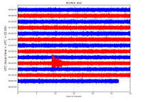
Seismograme teleseisme

Magnitude Mw 5.6
Region IRAN-IRAQ BORDER REGION
Date time 2019-01-06 13:41:57.7 UTC
Location 33.96 N ; 45.61 E
Depth 10 km
Distances 132 km NE of Baghdad, Iraq / pop: 5,673,000 / local time: 16:41:57.7 2019-01-06
83 km NW of ?l?m, Iran, Islamic Republic of / pop: 141,000 / local time: 17:11:57.7 2019-01-06
24 km N of Mandal?, Iraq / pop: 29,800 / local time: 16:41:57.7 2019-01-06

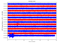
Magnitude Mw 5.0
Region SOUTHERN XINJIANG, CHINA
Date time 2019-01-06 16:22:30.8 UTC
Location 39.86 N ; 77.69 E
Depth 5 km
Distances 382 km S of Almaty, Kazakhstan / pop: 2,001,000 / local time: 22:22:30.8 2019-01-06
226 km SE of Naryn, Kyrgyzstan / pop: 52,300 / local time: 22:22:30.8 2019-01-06
154 km E of Kashi, China / pop: 275,000 / local time: 22:22:30.8 2019-01-06
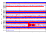
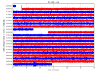
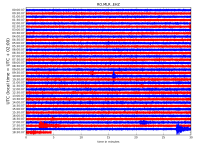
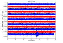
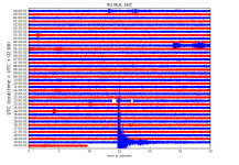
RO.MLR..EHZ.D.2019.006.png?1546792535377.png - Click image for larger version  Name:	RO.MLR..EHZ.D.2019.006.png?1546792535377.png Views:	1 Size:	254.2 KB ID:	4445


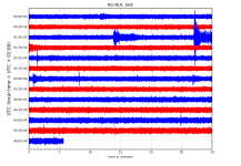
Magnitude Mw 6.6
Region MOLUCCA SEA
Date time 2019-01-06 17:27:18.9 UTC
Location 2.30 N ; 126.77 E
Depth 40 km
Distances 543 km S of Davao, Philippines / pop: 1,213,000 / local time: 01:27:18.9 2019-01-07
232 km NE of Manado, Indonesia / pop: 452,000 / local time: 01:27:18.9 2019-01-07
152 km NW of Tobelo, Indonesia / pop: 10,000 / local time: 02:27:18.9 2019-01-07
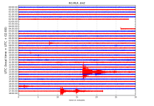
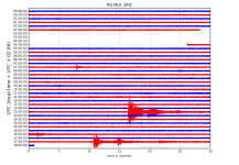
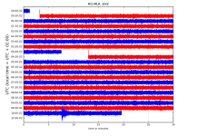
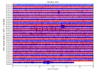
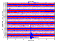
RO.MLR..EHZ.D.2019.006.png?1546792535377.png - Click image for larger version  Name:	RO.MLR..EHZ.D.2019.006.png?1546792535377.png Views:	1 Size:	245.4 KB ID:	4448


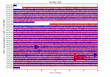
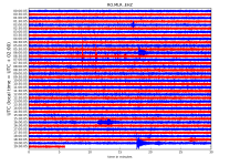
RO.MLR..EHZ.D.2019.006.png?1546792535377.png - Click image for larger version  Name:	RO.MLR..EHZ.D.2019.006.png?1546792535377.png Views:	1 Size:	247.9 KB ID:	4449

http://helitool.infp.ro/
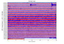
 
Magnitude mb 5.1
Region JAVA, INDONESIA
Date time 2019-01-08 09:54:49.7 UTC
Location 7.81 S ; 106.59 E
Depth 57 km
Distances 151 km SW of Bandung, Indonesia / pop: 1,700,000 / local time: 16:54:49.7 2019-01-08
91 km S of Pelabuhanratu, Indonesia / pop: 43,100 / local time: 16:54:49.7 2019-01-08

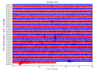
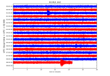
RO.MLR..EHZ.D.2019.008.png?1546926476619.png

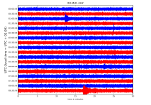
RO.MLR..EHZ.D.2019.008.png?1546926476619.png

http://helitool.infp.ro/
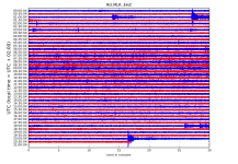
 
Magnitude Mw 6.3
Region KYUSHU, JAPAN
Date time 2019-01-08 12:39:29.8 UTC
Location 30.58 N ; 131.08 E
Depth 25 km
Distances 341 km S of Fukuoka-shi, Japan / pop: 1,393,000 / local time: 21:39:29.8 2019-01-08
120 km SE of Kagoshima-shi, Japan / pop: 556,000 / local time: 21:39:29.8 2019-01-08
19 km SE of Nishinoomote, Japan / pop: 17,900 / local time: 21:39:29.8 2019-01-08

RO.MLR..EHZ.D.2019.008.png?1546959742152.png

http://helitool.infp.ro/
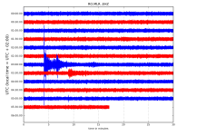
 
Magnitude Mw 5.8
Region KERMADEC ISLANDS REGION
Date time 2019-01-10 17:00:39.5 UTC
Location 27.11 S ; 175.53 W
Depth 10 km
Distances 663 km S of Nuku?alofa, Tonga / pop: 22,400 / local time: 06:00:39.5 2019-01-11
1170 km SE of Suva, Fiji / pop: 77,400 / local time: 06:00:39.5 2019-01-11
1507 km S of Pago Pago, American Samoa / pop: 11,500 / local time: 06:00:39.5 2019-01-10

Magnitude mb 4.8
Region IONIAN SEA
Date time 2019-01-10 17:30:14.2 UTC
Location 37.26 N ; 20.60 E
Depth 10 km
Distances 286 km W of Athens, Greece / pop: 730,000 / local time: 19:30:14.2 2019-01-10
148 km SW of P?tra, Greece / pop: 164,000 / local time: 19:30:14.2 2019-01-10
64 km SW of Z?kynthos, Greece / pop: 11,600 / local time: 19:30:14.2 2019-01-10
55 km S of Lithaki?, Greece / pop: 1,300 / local time: 19:30:14.2 2019-01-10

RO.MLR..EHZ.D.2019.010.png?1547135431767.png - Click image for larger version  Name:	RO.MLR..EHZ.D.2019.010.png?1547135431767.png Views:	1 Size:	338.5 KB ID:	4489


Magnitude mb 4.9
Region CRETE, GREECE
Date time 2019-01-10 18:24:37.2 UTC
Location 34.43 N ; 26.61 E
Depth 10 km
Distances 444 km S of ?zmir, Turkey / pop: 2,501,000 / local time: 21:24:37.2 2019-01-10
167 km SE of Ir?kleion, Greece / pop: 138,000 / local time: 20:24:37.2 2019-01-10
118 km SE of ?gios Nik?laos, Greece / pop: 10,800 / local time: 20:24:37.2 2019-01-10
90 km SE of Makry Gialos, Greece / pop: 4,300 / local time: 20:24:37.2 2019-01-10

RO.MLR..EHZ.D.2019.010.png?1547135431767.png - Click image for larger version  Name:	RO.MLR..EHZ.D.2019.010.png?1547135431767.png Views:	1 Size:	347.5 KB ID:	4490


http://helitool.infp.ro/
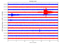
 
Magnitude Mw 5.2
Region TONGA
Date time 2019-01-11 05:58:13.6 UTC
Location 21.33 S ; 174.17 W
Depth 10 km
Distances 109 km E of Nuku?alofa, Tonga / pop: 22,400 / local time: 18:58:13.6 2019-01-11
81 km E of ?Ohonua, Tonga / pop: 1,300 / local time: 18:58:13.6 2019-01-11


RO.MLR..EHZ.D.2019.011.png?1547184897015.png - Click image for larger version  Name:	RO.MLR..EHZ.D.2019.011.png?1547184897015.png Views:	1 Size:	245.1 KB ID:	4496

http://helitool.infp.ro/
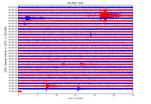
 
Magnitude ML 3.9
Region WESTERN TURKEY
Date time 2019-01-11 16:09:57.0 UTC
Location 40.29 N ; 28.85 E
Depth 5 km
Distances 21 km NW of Bursa, Turkey / pop: 1,413,000 / local time: 19:09:57.0 2019-01-11
10 km S of Mudanya, Turkey / pop: 23,200 / local time: 19:09:57.0 2019-01-11

RO.MLR..EHZ.D.2019.011.png?1547219933029.png - Click image for larger version  Name:	RO.MLR..EHZ.D.2019.011.png?1547219933029.png Views:	1 Size:	354.1 KB ID:	4502


Magnitude Mw 5.4
Region SOUTHERN SUMATRA, INDONESIA
Date time 2019-01-11 19:05:30.9 UTC
Location 3.30 S ; 101.42 E
Depth 46 km
Distances 372 km W of Palembang, Indonesia / pop: 1,442,000 / local time: 02:05:30.9 2019-01-12
109 km NW of Bengkulu, Indonesia / pop: 310,000 / local time: 02:05:30.9 2019-01-12

RO.MLR..EHZ.D.2019.011.png?1547219933029.png - Click image for larger version  Name:	RO.MLR..EHZ.D.2019.011.png?1547219933029.png Views:	1 Size:	383.5 KB ID:	4508

http://helitool.infp.ro/
 
Magnitude mb 5.3
Region SOUTHERN XINJIANG, CHINA
Date time 2019-01-12 04:32:05.0 UTC
Location 39.67 N ; 75.69 E
Depth 44 km
Distances 367 km S of Bishkek, Kyrgyzstan / pop: 900,000 / local time: 10:32:05.0 2019-01-12
197 km S of Naryn, Kyrgyzstan / pop: 52,300 / local time: 10:32:05.0 2019-01-12
167 km S of At-Bashi, Kyrgyzstan / pop: 15,300 / local time: 10:32:05.0 2019-01-12
35 km NW of Kashi, China / pop: 275,000 / local time: 10:32:05.0 2019-01-12

RO.MLR..EHZ.D.2019.012.png?1547274478435.png - Click image for larger version  Name:	RO.MLR..EHZ.D.2019.012.png?1547274478435.png Views:	1 Size:	228.3 KB ID:	4511

http://helitool.infp.ro/
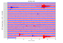
 
Magnitude ML 3.7
Region AEGEAN SEA
Date time 2019-01-14 06:59:36.8 UTC
Location 39.36 N ; 25.61 E
Depth 3 km
Distances 169 km NW of ?zmir, Turkey / pop: 2,501,000 / local time: 09:59:36.8 2019-01-14
86 km W of Mytil?ni, Greece / pop: 28,400 / local time: 08:59:36.8 2019-01-14
66 km SW of Bozcaada, Turkey / pop: 2,700 / local time: 09:59:36.8 2019-01-14
35 km NW of Eres?s, Greece / pop: 1,100 / local time: 08:59:36.8 2019-01-14

RO.MLR..EHZ.D.2019.014.png?1547444147409.png - Click image for larger version  Name:	RO.MLR..EHZ.D.2019.014.png?1547444147409.png Views:	1 Size:	232.0 KB ID:	4528

http://helitool.infp.ro/
 
Magnitude ML 4.3
Region GREECE
Date time 2019-01-15 01:11:48.6 UTC
Location 38.31 N ; 20.31 E
Depth 2 km
Distances 301 km W of Athens, Greece / pop: 730,000 / local time: 03:11:48.6 2019-01-15
125 km W of P?tra, Greece / pop: 164,000 / local time: 03:11:48.6 2019-01-15
21 km NW of Argost?lion, Greece / pop: 9,900 / local time: 03:11:48.6 2019-01-15
16 km NW of Lixo?rion, Greece / pop: 3,800 / local time: 03:11:48.6 2019-01-15

Magnitude mb 4.5
Region GREECE
Date time 2019-01-15 01:25:05.5 UTC
Location 38.93 N ; 20.55 E
Depth 10 km
Distances 273 km S of Tirana, Albania / pop: 375,000 / local time: 02:25:05.5 2019-01-15
86 km S of Io?nnina, Greece / pop: 64,100 / local time: 03:25:05.5 2019-01-15
17 km NW of Lefk?da, Greece / pop: 6,400 / local time: 03:25:05.5 2019-01-15


RO.MLR..EHZ.D.2019.015.png?1547532119172.png - Click image for larger version  Name:	RO.MLR..EHZ.D.2019.015.png?1547532119172.png Views:	1 Size:	185.3 KB ID:	4538

http://helitool.infp.ro/
 
Magnitude Mw 6.6
Region VANUATU
Date time 2019-01-15 18:06:37.0 UTC
Location 13.28 S ; 166.81 E
Depth 60 km
Distances 519 km N of Port-Vila, Vanuatu / pop: 36,000 / local time: 05:06:37.0 2019-01-16
252 km N of Luganville, Vanuatu / pop: 13,400 / local time: 05:06:37.0 2019-01-16
104 km NW of Sola, Vanuatu / pop: 1,200 / local time: 05:06:37.0 2019-01-16

RO.MLR..EHZ.D.2019.015.png?1547563224969.png - Click image for larger version  Name:	RO.MLR..EHZ.D.2019.015.png?1547563224969.png Views:	1 Size:	333.7 KB ID:	4542


Magnitude Mw 5.7
Region MINDANAO, PHILIPPINES
Date time 2019-01-15 20:03:21.9 UTC
Location 5.92 N ; 126.94 E
Depth 71 km
Distances 194 km SE of Davao, Philippines / pop: 1,213,000 / local time: 04:03:21.9 2019-01-16
140 km SE of Mati, Philippines / pop: 106,000 / local time: 04:03:21.9 2019-01-16
97 km SE of Pondaguitan, Philippines / pop: 2,200 / local time: 04:03:21.9 2019-01-16

RO.MLR..EHZ.D.2019.015.png?1547581574966.png - Click image for larger version  Name:	RO.MLR..EHZ.D.2019.015.png?1547581574966.png Views:	1 Size:	351.2 KB ID:	4544


http://helitool.infp.ro/
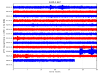
 
Magnitude mb 5.8
Region NICOBAR ISLANDS, INDIA REGION
Date time 2019-01-17 02:53:06.7 UTC
Location 7.32 N ; 94.33 E
Depth 100 km
Distances 634 km NW of Medan, Indonesia / pop: 1,751,000 / local time: 09:53:06.7 2019-01-17
224 km NW of Banda Aceh, Indonesia / pop: 251,000 / local time: 09:53:06.7 2019-01-17
192 km NW of Sabang, Indonesia / pop: 24,600 / local time: 09:53:06.7 2019-01-17


Magnitude Mw 4.5
Region SOUTHERN GREECE
Date time 2019-01-17 03:36:30.4 UTC
Location 36.36 N ; 22.20 E
Depth 10 km
Distances 225 km SW of Athens, Greece / pop: 730,000 / local time: 05:36:30.4 2019-01-17
128 km S of Tr?poli, Greece / pop: 26,600 / local time: 05:36:30.4 2019-01-17
76 km S of Kalam?ta, Greece / pop: 51,200 / local time: 05:36:30.4 2019-01-17
54 km SE of Kor?ni, Greece / pop: 1,700 / local time: 05:36:30.4 2019-01-17


RO.MLR..EHZ.D.2019.017.png?1547703768191.png - Click image for larger version  Name:	RO.MLR..EHZ.D.2019.017.png?1547703768191.png Views:	1 Size:	167.5 KB ID:	4555


http://helitool.infp.ro/
 
M 6.7 - 15km SSW of Coquimbo, Chile
  • 2019-01-20 01:32:51 (UTC)
  • 30.074?S 71.423?W
  • 53.0 km depth


Magnitude Mw 6.7
Region COQUIMBO, CHILE
Date time 2019-01-20 01:32:51.3 UTC
Location 30.07 S ; 71.30 W
Depth 55 km
Distances 381 km N of Santiago, Chile / pop: 4,838,000 / local time: 22:32:51.3 2019-01-19
19 km S of La Serena, Chile / pop: 155,000 / local time: 22:32:51.3 2019-01-19

RO.MLR..EHZ.D.2019.020.png?1547966968891.png - Click image for larger version  Name:	RO.MLR..EHZ.D.2019.020.png?1547966968891.png Views:	1 Size:	169.5 KB ID:	4581

http://helitool.infp.ro/
 
mb 5.2 Xizang

http://ds.iris.edu/ds/nodes/dmc/tools/event/10997721 Event Summary
2019-01-20 14:28:30 UTC
(1 hour, 7 minutes ago)
Xizang
mb 5.2
30.3894? N
87.6129? E
9.6 km

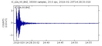
Magnitude mb 5.2
Region WESTERN XIZANG
Date time 2019-01-20 14:28:30.3 UTC
Location 30.39 N ; 87.61 E
Depth 10 km
Distances 372 km NE of Kathmandu, Nepal / pop: 1,443,000 / local time: 20:13:30.3 2019-01-20
347 km W of Lhasa, China / pop: 119,000 / local time: 22:28:30.3 2019-01-20
176 km NW of Rikaze, China / pop: 80,000 / local time: 20:28:30.3 2019-01-20


RO.MLR..EHZ.D.2019.020.png?1547998256962.png - Click image for larger version  Name:	RO.MLR..EHZ.D.2019.020.png?1547998256962.png Views:	1 Size:	286.0 KB ID:	4585

http://helitool.infp.ro/
query?output=plot&width=550&height=250&net=IC&sta=LSA&loc=00&cha=BHZ&starttime=2019-01-20T14%3A28%3A30&duration=1800.png - Click image for larger version  Name:	query?output=plot&width=550&height=250&net=IC&sta=LSA&loc=00&cha=BHZ&starttime=2019-01-20T14%3A28%3A30&duration=1800.png Views:	1 Size:	1.9 KB ID:	4587


http://ds.iris.edu/ds/nodes/dmc/tools/event/10997721
 
Mww4.9 Eastern Mediterranean Sea

Event Summary
2019-01-20 15:49:50 UTC
(44 minutes ago)
Eastern Mediterranean Sea
Mww 4.9
35.5998? N
28.2831? E
10.0 km
Magnitude Mw 4.9
Region EASTERN MEDITERRANEAN SEA
Date time 2019-01-20 15:49:50.2 UTC
Location 35.69 N ; 28.28 E
Depth 10 km
Distances 319 km S of ?zmir, Turkey / pop: 2,501,000 / local time: 18:49:50.2 2019-01-20
170 km S of Mu?la, Turkey / pop: 48,200 / local time: 18:49:50.2 2019-01-20
83 km S of R?dos, Greece / pop: 56,200 / local time: 17:49:50.2 2019-01-20
51 km SE of L?rdos, Greece / pop: 1,400 / local time: 17:49:50.2 2019-01-20

http://ds.iris.edu/ds/nodes/dmc/tools/event/10997738
RO.MLR..EHZ.D.2019.020.png?1547998256962.png - Click image for larger version  Name:	RO.MLR..EHZ.D.2019.020.png?1547998256962.png Views:	1 Size:	270.7 KB ID:	4589


http://helitool.infp.ro/
 
Mww6.0 Sumba Region, Indonesia

Event Summary
2019-01-21 23:59:22 UTC
(6 hours, 25 minutes ago)
Sumba Region, Indonesia
Mww 6.0
10.3113? S
119.1472? E
16.77 km

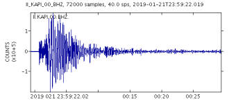
Magnitude Mw 6.0
Region SUMBA REGION, INDONESIA
Date time 2019-01-21 23:59:22.6 UTC
Location 10.31 S ; 119.15 E
Depth 17 km
Distances 573 km S of Makassar, Indonesia / pop: 1,322,000 / local time: 07:59:22.6 2019-01-22
384 km SE of Mataram, Indonesia / pop: 319,000 / local time: 07:59:22.6 2019-01-22
142 km SW of Waingapu, Indonesia / pop: 48,900 / local time: 07:59:22.6 2019-01-22

query?output=plot&width=550&height=250&net=II&sta=KAPI&loc=00&cha=BHZ&starttime=2019-01-21T23%3A59%3A22&duration=1800.png - Click image for larger version  Name:	query?output=plot&width=550&height=250&net=II&sta=KAPI&loc=00&cha=BHZ&starttime=2019-01-21T23%3A59%3A22&duration=1800.png Views:	1 Size:	2.5 KB ID:	4598Mww6.4 Sumba Region, Indonesia

Event Summary

2019-01-22 05:10:03 UTC
(1 hour, 15 minutes ago)
Sumba Region, Indonesia
Mww 6.4
10.4663? S
119.0309? E
27.01 km

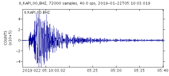
Magnitude Mw 6.4
Region SUMBA REGION, INDONESIA
Date time 2019-01-22 05:10:03.7 UTC
Location 10.47 S ; 119.03 E
Depth 27 km
Distances 591 km S of Makassar, Indonesia / pop: 1,322,000 / local time: 13:10:03.7 2019-01-22
382 km SE of Mataram, Indonesia / pop: 319,000 / local time: 13:10:03.7 2019-01-22
162 km SW of Waingapu, Indonesia / pop: 48,900 / local time: 13:10:03.7 2019-01-22

query?output=plot&width=550&height=250&net=II&sta=KAPI&loc=00&cha=BHZ&starttime=2019-01-22T05%3A10%3A03&duration=1800.png - Click image for larger version  Name:	query?output=plot&width=550&height=250&net=II&sta=KAPI&loc=00&cha=BHZ&starttime=2019-01-22T05%3A10%3A03&duration=1800.png Views:	1 Size:	2.6 KB ID:	4599

query?output=plot&width=550&height=250&net=II&sta=KAPI&loc=00&cha=BHZ&starttime=2019-01-21T23%3A59%3A22&duration=1800.png - Click image for larger version  Name:	query?output=plot&width=550&height=250&net=II&sta=KAPI&loc=00&cha=BHZ&starttime=2019-01-21T23%3A59%3A22&duration=1800.png Views:	1 Size:	2.5 KB ID:	4598

http://helitool.infp.ro/
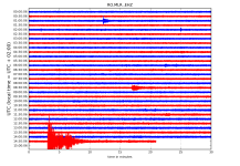
 
Magnitude Mw 6.7
Region PRINCE EDWARD ISLANDS REGION
Date time 2019-01-22 19:01:44.4 UTC
Location 43.09 S ; 42.21 E
Depth 10 km
Distances 2016 km SE of Maseru, Lesotho / pop: 119,000 / local time: 21:01:44.4 2019-01-22
2092 km S of Maputo, Mozambique / pop: 1,192,000 / local time: 21:01:44.4 2019-01-22
2115 km SE of Mbabane, Swaziland / pop: 76,300 / local time: 21:01:44.4 2019-01-22

RO.MLR..EHZ.D.2019.022.png?1548168868556.png

http://helitool.infp.ro/
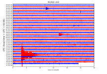
 
Magnitude mb 4.8
Region DODECANESE IS.-TURKEY BORDER REG
Date time 2019-01-22 20:12:07.2 UTC
Location 36.81 N ; 28.02 E
Depth 76 km
Distances 194 km SE of ?zmir, Turkey / pop: 2,501,000 / local time: 23:12:07.2 2019-01-22
55 km SW of Mu?la, Turkey / pop: 48,200 / local time: 23:12:07.2 2019-01-22
45 km NW of R?dos, Greece / pop: 56,200 / local time: 22:12:07.2 2019-01-22
23 km W of Marmaris, Turkey / pop: 33,800 / local time: 23:12:07.2 2019-01-22

RO.MLR..EHZ.D.2019.022.png?1548168868556.png - Click image for larger version  Name:	RO.MLR..EHZ.D.2019.022.png?1548168868556.png Views:	1 Size:	331.1 KB ID:	4608

http://helitool.infp.ro/
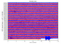
 
Magnitude mb 5.5
Region TONGA
Date time 2019-01-24 00:52:38.2 UTC
Location 15.07 S ; 173.43 W
Depth 10 km
Distances 226 km SW of Apia, Samoa / pop: 40,500 / local time: 14:52:38.2 2019-01-24
182 km SW of Gataivai, Samoa / pop: 1,200 / local time: 14:52:38.2 2019-01-24

RO.MLR..EHZ.D.2019.024.png?1548311395213.png


Magnitude Mw 5.5
Region BABUYAN ISL REGION, PHILIPPINES
Date time 2019-01-24 08:34:54.6 UTC
Location 19.21 N ; 121.22 E
Depth 40 km
Distances 389 km S of Kaohsiung, Taiwan, Province of China / pop: 1,520,000 / local time: 16:34:54.6 2019-01-24
185 km N of Tuguegarao City, Philippines / pop: 116,000 / local time: 16:34:54.6 2019-01-24
121 km NW of Buguey, Philippines / pop: 3,200 / local time: 16:34:54.6 2019-01-24
67 km N of Namuac, Philippines / pop: 3,100 / local time: 16:34:54.6 2019-01-24

RO.MLR..EHZ.D.2019.024.png?1548311395213.png

http://helitool.infp.ro/
 
Magnitude Mw 5.3
Region EASTERN MEDITERRANEAN SEA
Date time 2019-01-24 14:30:54.3 UTC
Location 35.94 N ; 28.14 E
Depth 60 km
Distances 288 km S of ?zmir, Turkey / pop: 2,501,000 / local time: 17:30:54.3 2019-01-24
143 km S of Mu?la, Turkey / pop: 48,200 / local time: 17:30:54.3 2019-01-24
56 km S of R?dos, Greece / pop: 56,200 / local time: 16:30:54.3 2019-01-24
20 km SE of L?rdos, Greece / pop: 1,400 / local time: 16:30:54.3 2019-01-24

RO.MLR..EHZ.D.2019.024.png?1548311395213.png - Click image for larger version  Name:	RO.MLR..EHZ.D.2019.024.png?1548311395213.png Views:	1 Size:	258.7 KB ID:	4628

RO.MLR..EHZ.D.2019.024.png?1548311395213.png - Click image for larger version  Name:	RO.MLR..EHZ.D.2019.024.png?1548311395213.png Views:	1 Size:	300.9 KB ID:	4629

http://helitool.infp.ro/
 
Magnitude ML 4.5
Region WESTERN TURKEY
Date time 2019-01-25 20:20:33.6 UTC
Location 38.56 N ; 27.08 E
Depth 7 km
Distances 17 km N of ?zmir, Turkey / pop: 2,501,000 / local time: 23:20:33.6 2019-01-25
5 km S of Menemen, Turkey / pop: 53,500 / local time: 23:20:33.6 2019-01-25

RO.MLR..EHZ.D.2019.025.png?1548436445857.png - Click image for larger version  Name:	RO.MLR..EHZ.D.2019.025.png?1548436445857.png Views:	1 Size:	364.2 KB ID:	4635


http://helitool.infp.ro/
 
Back
Sus