• Bine ati venit! Acesta este noul server al forumului Cutremur.net!

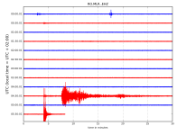
Seismograme teleseisme

Magnitude Mw 5.6
Region FIJI REGION
Date time 2018-11-27 02:45:32.7 UTC
Location 17.85 S ; 178.57 W
Depth 572 km
Distances 318 km E of Suva, Fiji / pop: 77,400 / local time: 15:45:32.7 2018-11-27
269 km SE of Lambasa, Fiji / pop: 24,200 / local time: 15:45:32.7 2018-11-27
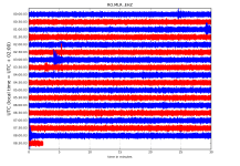

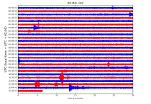
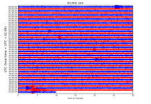
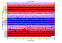
RO.MLR..EHZ.D.2018.331.png?1543296281138.png

http://helitool.infp.ro/
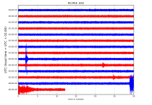
 
Magnitude Mw 5.8
Region NORTH OF ASCENSION ISLAND
Date time 2018-11-27 12:03:27.5 UTC
Location 1.02 S ; 13.67 W
Depth 10 km
Distances 870 km S of Monrovia, Liberia / pop: 940,000 / local time: 12:03:27.5 2018-11-27
843 km SW of Greenville, Liberia / pop: 16,500 / local time: 12:03:27.5 2018-11-27


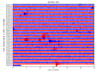
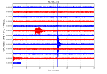
RO.MLR..EHZ.D.2018.331.png?1543296281138.png - Click image for larger version  Name:	RO.MLR..EHZ.D.2018.331.png?1543296281138.png Views:	1 Size:	262.4 KB ID:	3844


http://helitool.infp.ro/
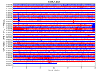
 
Magnitude Mw 5.5
Region NORTH ATLANTIC OCEAN
Date time 2018-11-27 19:34:45.8 UTC
Location 15.62 N ; 49.81 W
Depth 10 km
Distances 1094 km E of Bridgetown, Barbados / pop: 98,600 / local time: 15:34:45.8 2018-11-27
1214 km N of Cayenne, French Guiana / pop: 61,600 / local time: 16:34:45.8 2018-11-27
1216 km E of Fort-de-France, Martinique / pop: 90,000 / local time: 15:34:45.8 2018-11-27

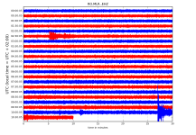
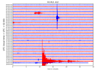
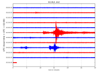
RO.MLR..EHZ.D.2018.331.png?1543334577018.png - Click image for larger version  Name:	RO.MLR..EHZ.D.2018.331.png?1543334577018.png Views:	1 Size:	349.3 KB ID:	3846

http://helitool.infp.ro/
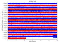
 
Magnitude Mw 5.3
Region MYANMAR-INDIA BORDER REGION
Date time 2018-11-28 10:17:05.9 UTC
Location 27.18 N ; 97.03 E
Depth 10 km
Distances 318 km W of Dayan, China / pop: 1,138,000 / local time: 18:17:05.9 2018-11-28
202 km N of Myitkyin?, Myanmar / pop: 90,900 / local time: 16:47:05.9 2018-11-28
118 km SE of Tezu, India / pop: 15,000 / local time: 15:47:05.9 2018-11-28

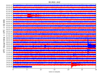
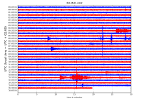
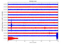
RO.MLR..EHZ.D.2018.332.png?1543383231266.png - Click image for larger version  Name:	RO.MLR..EHZ.D.2018.332.png?1543383231266.png Views:	1 Size:	254.1 KB ID:	3856

http://helitool.infp.ro/
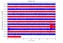
 
Magnitude Mw 4.9
Region HINDU KUSH REGION, AFGHANISTAN
Date time 2018-11-28 14:44:25.3 UTC
Location 35.81 N ; 68.81 E
Depth 20 km
Distances 146 km N of Kabul, Afghanistan / pop: 3,044,000 / local time: 19:14:25.3 2018-11-28
17 km SE of Pul-e Khumr?, Afghanistan / pop: 56,400 / local time: 19:14:25.3 2018-11-28

RO.MLR..EHZ.D.2018.332.png?1543416122029.png


http://helitool.infp.ro/
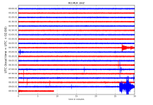
 
Magnitude mb 4.6
Region IONIAN SEA
Date time 2018-11-29 00:23:01.9 UTC
Location 37.57 N ; 20.34 E
Depth 10 km
Distances 301 km W of Athens, Greece / pop: 730,000 / local time: 02:23:01.9 2018-11-29
144 km SW of P?tra, Greece / pop: 164,000 / local time: 02:23:01.9 2018-11-29
55 km SW of Z?kynthos, Greece / pop: 11,600 / local time: 02:23:01.9 2018-11-29
46 km SW of Mouzaki, Greece / pop: 1,600 / local time: 02:23:01.9 2018-11-29

Magnitude Mw 5.8
Region NIAS REGION, INDONESIA
Date time 2018-11-29 20:21:44.7 UTC
Location 0.26 N ; 97.05 E
Depth 10 km
Distances 409 km SW of Medan, Indonesia / pop: 1,751,000 / local time: 03:21:44.7 2018-11-30
391 km W of Padang, Indonesia / pop: 841,000 / local time: 03:21:44.7 2018-11-30
375 km W of Bukittinggi, Indonesia / pop: 98,800 / local time: 03:21:44.7 2018-11-30
253 km SW of Sibolga, Indonesia / pop: 79,800 / local time: 03:21:44.7 2018-11-30

RO.MLR..EHZ.D.2018.333.png?1543509835144.png - Click image for larger version  Name:	RO.MLR..EHZ.D.2018.333.png?1543509835144.png Views:	1 Size:	385.4 KB ID:	3870

http://helitool.infp.ro/
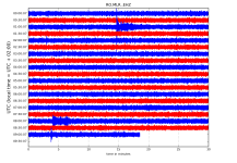
 
Magnitude mb 4.2
Region WESTERN TURKEY
Date time 2018-11-30 02:36:35.4 UTC
Location 40.59 N ; 28.98 E
Depth 7 km
Distances 45 km N of Bursa, Turkey / pop: 1,413,000 / local time: 05:36:35.4 2018-11-30
26 km W of Yalova, Turkey / pop: 71,300 / local time: 05:36:35.4 2018-11-30
6 km SW of Kocadere, Turkey / pop: 1,200 / local time: 05:36:35.4 2018-11-30


RO.MLR..EHZ.D.2018.334.png?1543556971195.png - Click image for larger version  Name:	RO.MLR..EHZ.D.2018.334.png?1543556971195.png Views:	1 Size:	158.4 KB ID:	3874

http://helitool.infp.ro/
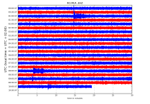
 
Magnitude Mw 7.0
Region SOUTHERN ALASKA
Date time 2018-11-30 17:29:27.8 UTC
Location 61.33 N ; 149.92 W
Depth 57 km
Distances 2143 km NW of Vancouver, Canada / pop: 1,838,000 / local time: 09:29:27.8 2018-11-30
805 km W of Whitehorse, Canada / pop: 23,300 / local time: 09:29:27.8 2018-11-30
13 km N of Anchorage, United States / pop: 292,000 / local time: 08:29:27.8 2018-11-30

RO.MLR..EHZ.D.2018.334.png?1543602446858.png - Click image for larger version  Name:	RO.MLR..EHZ.D.2018.334.png?1543602446858.png Views:	1 Size:	255.6 KB ID:	3886

http://helitool.infp.ro/
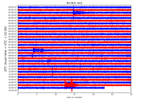
 
Magnitude Mw 6.3
Region KEPULAUAN BARAT DAYA, INDONESIA
Date time 2018-12-01 13:27:20.8 UTC
Location 7.40 S ; 128.71 E
Depth 143 km
Distances 369 km E of Dili, Timor-Leste / pop: 150,000 / local time: 22:27:20.8 2018-12-01
2046 km W of Port Moresby, Papua New Guinea / pop: 284,000 / local time: 23:27:20.8 2018-12-01
2049 km SE of Bandar Seri Begawan, Brunei Darussalam / pop: 64,500 / local time: 21:27:20.8 2018-12-01


Magnitude mb 4.9
Region ARUNACHAL PRADESH, INDIA
Date time 2018-12-01 15:07:28.1 UTC
Location 27.99 N ; 92.75 E
Depth 10 km
Distances 312 km E of Thimphu, Bhutan / pop: 98,700 / local time: 21:07:28.1 2018-12-01
130 km E of Trashi Yangtse, Bhutan / pop: 3,100 / local time: 21:07:28.1 2018-12-01
89 km NE of Bomdila, India / pop: 7,200 / local time: 20:37:28.1 2018-12-01

RO.MLR..EHZ.D.2018.335.png?1543648183833.png - Click image for larger version  Name:	RO.MLR..EHZ.D.2018.335.png?1543648183833.png Views:	1 Size:	292.2 KB ID:	3906

http://helitool.infp.ro/
 
Magnitude ML 3.6
Region WESTERN TURKEY
Date time 2018-12-04 12:38:03.6 UTC
Location 40.67 N ; 26.98 E
Depth 11 km
Distances 170 km W of ?stanbul, Turkey / pop: 11,175,000 / local time: 15:38:03.6 2018-12-04
56 km SW of Tekirda?, Turkey / pop: 123,000 / local time: 15:38:03.6 2018-12-04
39 km NE of Gelibolu, Turkey / pop: 25,200 / local time: 15:38:03.6 2018-12-04
25 km S of Malkara, Turkey / pop: 27,500 / local time: 15:38:03.6 2018-12-04

RO.MLR..EHZ.D.2018.338.png?1543938359282.png

http://helitool.infp.ro/
 
Magnitude Mw 7.5
Region SOUTHEAST OF LOYALTY ISLANDS
Date time 2018-12-05 04:18:07.9 UTC
Location 21.92 S ; 169.49 E
Depth 10 km
Distances 315 km E of Noum?a, New Caledonia / pop: 93,100 / local time: 15:18:07.9 2018-12-05
256 km SE of W?, New Caledonia / pop: 10,400 / local time: 15:18:07.9 2018-12-05
171 km E of Tadine, New Caledonia / pop: 7,500 / local time: 15:18:07.9 2018-12-05

RO.MLR..EHZ.D.2018.339.png?1543987834440.png - Click image for larger version  Name:	RO.MLR..EHZ.D.2018.339.png?1543987834440.png Views:	1 Size:	107.8 KB ID:	3936

http://helitool.infp.ro/
 
Magnitude Mw 7.1
Region SOUTH SANDWICH ISLANDS REGION
Date time 2018-12-11 02:26:30.6 UTC
Location 58.65 S ; 26.44 W
Depth 150 km
Distances 3432 km SE of Montevideo, Uruguay / pop: 1,271,000 / local time: 23:26:30.6 2018-12-10
3557 km SE of Buenos Aires, Argentina / pop: 13,077,000 / local time: 23:26:30.6 2018-12-10
4294 km SE of Santiago, Chile / pop: 4,838,000 / local time: 23:26:30.6 2018-12-10


Magnitude ML 4.0
Region AEGEAN SEA
Date time 2018-12-11 04:11:44.0 UTC
Location 39.54 N ; 24.26 E
Depth 14 km
Distances 180 km N of Athens, Greece / pop: 730,000 / local time: 06:11:44.0 2018-12-11
158 km E of L?risa, Greece / pop: 129,000 / local time: 06:11:44.0 2018-12-11
115 km E of V?los, Greece / pop: 84,500 / local time: 06:11:44.0 2018-12-11
55 km NE of Patit?rion, Greece / pop: 1,700 / local time: 06:11:44.0 2018-12-11


RO.MLR..EHZ.D.2018.345.png?1544506162347.png - Click image for larger version  Name:	RO.MLR..EHZ.D.2018.345.png?1544506162347.png Views:	1 Size:	127.2 KB ID:	4019

http://helitool.infp.ro/
 
Magnitude mb 4.9
Region IONIAN SEA
Date time 2018-12-13 06:26:41.8 UTC
Location 37.57 N ; 20.68 E
Depth 10 km
Distances 271 km W of Athens, Greece / pop: 730,000 / local time: 08:26:41.8 2018-12-13
119 km SW of P?tra, Greece / pop: 164,000 / local time: 08:26:41.8 2018-12-13
31 km SW of Z?kynthos, Greece / pop: 11,600 / local time: 08:26:41.8 2018-12-13
21 km SW of Lithaki?, Greece / pop: 1,300 / local time: 08:26:41.8 2018-12-13

RO.MLR..EHZ.D.2018.347.png?1544681455353.png - Click image for larger version  Name:	RO.MLR..EHZ.D.2018.347.png?1544681455353.png Views:	1 Size:	166.0 KB ID:	4061

RO.MLR..EHZ.D.2018.347.png?1544681455353.png - Click image for larger version  Name:	RO.MLR..EHZ.D.2018.347.png?1544681455353.png Views:	1 Size:	168.8 KB ID:	4062

http://helitool.infp.ro/
 
Magnitude mb 5.1
Region EASTERN XIZANG
Date time 2018-12-13 15:32:52.9 UTC
Location 29.74 N ; 98.82 E
Depth 15 km
Distances 347 km NW of Dayan, China / pop: 1,138,000 / local time: 23:32:52.9 2018-12-13
220 km SE of Qamdo, China / pop: 86,300 / local time: 23:32:52.9 2018-12-13

RO.MLR..EHZ.D.2018.347.png?1544714473654.png - Click image for larger version  Name:	RO.MLR..EHZ.D.2018.347.png?1544714473654.png Views:	1 Size:	307.4 KB ID:	4074


http://helitool.infp.ro/
 
Magnitude ML 3.8
Region WESTERN TURKEY
Date time 2018-12-15 09:26:07.3 UTC
Location 40.38 N ; 28.99 E
Depth 6 km
Distances 22 km N of Bursa, Turkey / pop: 1,413,000 / local time: 12:26:07.3 2018-12-15
9 km E of Mudanya, Turkey / pop: 23,200 / local time: 12:26:07.3 2018-12-15

RO.MLR..EHZ.D.2018.349.png?1544855641797.png - Click image for larger version  Name:	RO.MLR..EHZ.D.2018.349.png?1544855641797.png Views:	1 Size:	257.2 KB ID:	4096

http://helitool.infp.ro/
 
Magnitude Mw 5.4
Region SICHUAN-GUIZHOU BORDER RG, CHINA
Date time 2018-12-16 04:46:10.6 UTC
Location 28.27 N ; 105.05 E
Depth 25 km
Distances 205 km SW of Chongqing, China / pop: 3,968,000 / local time: 12:46:10.6 2018-12-16
98 km W of Taiping, China / pop: 3,000 / local time: 12:46:10.6 2018-12-16

RO.MLR..EHZ.D.2018.350.png?1544942480180.png - Click image for larger version  Name:	RO.MLR..EHZ.D.2018.350.png?1544942480180.png Views:	1 Size:	209.2 KB ID:	4099


http://helitool.infp.ro/
 
Magnitude ML 4.3
Region AEGEAN SEA
Date time 2018-12-16 09:24:30.0 UTC
Location 39.55 N ; 24.29 E
Depth 4 km
Distances 181 km N of Athens, Greece / pop: 730,000 / local time: 11:24:30.0 2018-12-16
117 km SE of Pol?gyros, Greece / pop: 10,000 / local time: 11:24:30.0 2018-12-16
57 km NE of Patit?rion, Greece / pop: 1,700 / local time: 11:24:30.0 2018-12-16

RO.MLR..EHZ.D.2018.350.png?1544942480180.png - Click image for larger version  Name:	RO.MLR..EHZ.D.2018.350.png?1544942480180.png Views:	1 Size:	188.3 KB ID:	4110

http://helitool.infp.ro/
 
Magnitude ML 3.8
Region GREECE
Date time 2018-12-17 08:02:22.7 UTC
Location 39.45 N ; 21.83 E
Depth 8 km
Distances 231 km NW of Athens, Greece / pop: 730,000 / local time: 10:02:22.7 2018-12-17
55 km W of L?risa, Greece / pop: 129,000 / local time: 10:02:22.7 2018-12-17
12 km NW of Kard?tsa, Greece / pop: 32,800 / local time: 10:02:22.7 2018-12-17
2 km E of Mago?la, Greece / pop: 1,100 / local time: 10:02:22.7 2018-12-17


RO.MLR..EHZ.D.2018.351.png?1545027369891.png

http://helitool.infp.ro/
 
Magnitude mb 4.7
Region CASPIAN SEA, OFFSHORE AZERBAIJAN
Date time 2018-12-17 10:03:34.8 UTC
Location 38.46 N ; 49.55 E
Depth 10 km
Distances 215 km S of Baku, Azerbaijan / pop: 1,117,000 / local time: 14:03:34.8 2018-12-17
105 km S of Neft?ala, Azerbaijan / pop: 18,700 / local time: 14:03:34.8 2018-12-17
59 km E of Astara, Azerbaijan / pop: 15,200 / local time: 14:03:34.8 2018-12-17


RO.MLR..EHZ.D.2018.351.png?1545027369891.png

http://helitool.infp.ro/
 
Magnitude ML 4.1
Region NEAR THE COAST OF WESTERN TURKEY
Date time 2018-12-17 14:40:55.6 UTC
Location 39.52 N ; 26.18 E
Depth 6 km
Distances 148 km NW of ?zmir, Turkey / pop: 2,501,000 / local time: 17:40:55.6 2018-12-17
56 km NW of Mytil?ni, Greece / pop: 28,400 / local time: 16:40:55.6 2018-12-17
21 km SW of Ayvac?k, Turkey / pop: 6,900 / local time: 17:40:55.6 2018-12-17
13 km W of Behram, Turkey / pop: 1,100 / local time: 17:40:55.6 2018-12-17

RO.MLR..EHZ.D.2018.351.png?1545060232060.png


http://helitool.infp.ro/
 
Back
Sus