• Bine ati venit! Acesta este noul server al forumului Cutremur.net!

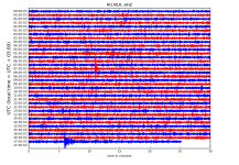
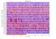
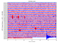
Seismograme teleseisme

Magnitude mb 4.7
Region WESTERN TURKEY
Date time 2018-07-23 02:40:24.1 UTC
Location 37.55 N ; 29.81 E
Depth 10 km
Distances 253 km E of ?zmir, Turkey / pop: 2,501,000 / local time: 05:40:24.1 2018-07-23
46 km SW of Burdur, Turkey / pop: 66,200 / local time: 05:40:24.1 2018-07-23
7 km NE of Ye?ilova, Turkey / pop: 6,800 / local time: 05:40:24.1 2018-07-23

Magnitude Mw 5.9
Region CENTRAL MID-ATLANTIC RIDGE
Date time 2018-07-23 10:36:00.1 UTC
Location 0.34 S ; 19.27 W
Depth 10 km
Distances 1184 km SW of Freetown, Sierra Leone / pop: 803,000 / local time: 10:36:00.1 2018-07-23
1194 km SW of Monrovia, Liberia / pop: 940,000 / local time: 10:36:00.1 2018-07-23
1256 km SW of Conakry, Guinea / pop: 1,768,000 / local time: 10:36:00.1 2018-07-23
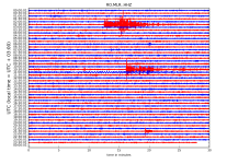
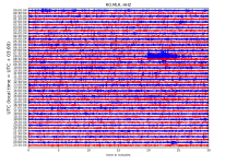
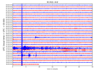
RO.MLR..HHZ.D.2018.204.png?1532700927620.png


http://helitool.infp.ro/
 
Magnitude mb 4.4
Region DODECANESE ISLANDS, GREECE
Date time 2018-07-26 08:17:51.1 UTC
Location 37.74 N ; 26.72 E
Depth 1 km
Distances 83 km SW of ?zmir, Turkey / pop: 2,501,000 / local time: 11:17:51.1 2018-07-26
23 km W of S?mos, Greece / pop: 1,900 / local time: 11:17:51.1 2018-07-26
3 km NE of Marath?kampos, Greece / pop: 1,300 / local time: 11:17:51.1 2018-07-26

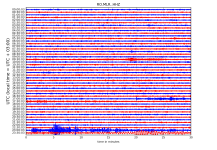
RO.MLR..HHZ.D.2018.207.png?1532782446519.png

http://helitool.infp.ro/
 
Magnitude Mw 6.0
Region FLORES SEA
Date time 2018-07-28 17:07:23.9 UTC
Location 7.16 S ; 122.70 E
Depth 593 km
Distances 353 km NW of Dili, Timor-Leste / pop: 150,000 / local time: 02:07:23.9 2018-07-29
170 km N of Maumere, Indonesia / pop: 47,600 / local time: 01:07:23.9 2018-07-29

Magnitude Mw 6.4
Region LOMBOK REGION, INDONESIA
Date time 2018-07-28 22:47:37.4 UTC
Location 8.34 S ; 116.48 E
Depth 10 km
Distances 429 km E of Surabaya, Indonesia / pop: 2,375,000 / local time: 05:47:37.4 2018-07-29
48 km NE of Mataram, Indonesia / pop: 319,000 / local time: 06:47:37.4 2018-07-29

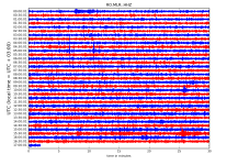
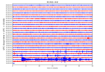
RO.MLR..HHZ.D.2018.209.png?1532889053117.png


http://helitool.infp.ro/
 
Magnitude mb 5.1
Region WESTERN XIZANG
Date time 2018-08-01 15:46:23.8 UTC
Location 30.35 N ; 87.71 E
Depth 10 km
Distances 371 km NW of Thimphu, Bhutan / pop: 98,700 / local time: 21:46:23.8 2018-08-01
336 km W of Lhasa, China / pop: 119,000 / local time: 23:46:23.8 2018-08-01
167 km NW of Rikaze, China / pop: 80,000 / local time: 21:46:23.8 2018-08-01


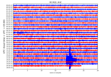
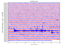
RO.MLR..HHZ.D.2018.213.png?1533142070837.png - Click image for larger version  Name:	RO.MLR..HHZ.D.2018.213.png?1533142070837.png Views:	1 Size:	384.3 KB ID:	2084


http://helitool.infp.ro/
 
Magnitude mb 4.5
Region SOUTHERN GREECE
Date time 2018-08-02 06:56:53.5 UTC
Location 36.78 N ; 21.34 E
Depth 10 km
Distances 249 km SW of Athens, Greece / pop: 730,000 / local time: 09:56:53.5 2018-08-02
123 km SW of Tr?poli, Greece / pop: 26,600 / local time: 09:56:53.5 2018-08-02
75 km W of Kalam?ta, Greece / pop: 51,200 / local time: 09:56:53.5 2018-08-02
33 km W of Meth?ni, Greece / pop: 1,200 / local time: 09:56:53.5 2018-08-02


Magnitude ML 4.1
Region BULGARIA
Date time 2018-08-02 14:17:37.6 UTC
Location 41.69 N ; 23.59 E
Depth 10 km
Distances 114 km S of Sofia, Bulgaria / pop: 1,153,000 / local time: 17:17:37.6 2018-08-02
55 km SE of Blagoevgrad, Bulgaria / pop: 71,400 / local time: 17:17:37.6 2018-08-02
18 km NW of Gotse Delchev, Bulgaria / pop: 20,500 / local time: 17:17:37.6 2018-08-02


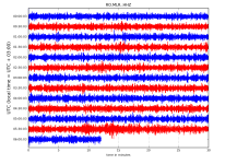
RO.MLR..HHZ.D.2018.214.png?1533225393664.png

http://helitool.infp.ro/
 
Magnitude mb 5.3
Region KEP. MENTAWAI REGION, INDONESIA
Date time 2018-08-05 08:56:23.5 UTC
Location 2.25 S ; 99.52 E
Depth 10 km
Distances 586 km W of Palembang, Indonesia / pop: 1,442,000 / local time: 15:56:23.5 2018-08-05
171 km SW of Padang, Indonesia / pop: 841,000 / local time: 15:56:23.5 2018-08-05


Magnitude Mw 6.9
Region LOMBOK REGION, INDONESIA
Date time 2018-08-05 11:46:37.3 UTC
Location 8.32 S ; 116.46 E
Depth 33 km
Distances 426 km E of Surabaya, Indonesia / pop: 2,375,000 / local time: 18:46:37.3 2018-08-05
48 km NE of Mataram, Indonesia / pop: 319,000 / local time: 19:46:37.3 2018-08-05


RO.MLR..HHZ.D.2018.217.png?1533451376540.png


http://helitool.infp.ro/
 
Magnitude Mw 5.7
Region GREENLAND SEA
Date time 2018-08-07 13:57:09.6 UTC
Location 74.73 N ; 8.78 E
Depth 10 km
Distances 1650 km NE of Reykjav?k, Iceland / pop: 114,000 / local time: 13:57:09.6 2018-08-07
663 km NW of Troms?, Norway / pop: 52,500 / local time: 15:57:09.6 2018-08-07


RO.MLR..HHZ.D.2018.219.png?1533647890302.png - Click image for larger version  Name:	RO.MLR..HHZ.D.2018.219.png?1533647890302.png Views:	1 Size:	276.4 KB ID:	2131


http://helitool.infp.ro/
 
Magnitude Mw 5.6
Region OFF EAST COAST OF HONSHU, JAPAN
Date time 2018-08-07 15:12:56.5 UTC
Location 37.88 N ; 144.12 E
Depth 10 km
Distances 288 km E of Sendai-shi, Japan / pop: 1,038,000 / local time: 00:12:56.5 2018-08-08
248 km SE of ?funato, Japan / pop: 35,500 / local time: 00:12:56.5 2018-08-08

RO.MLR..HHZ.D.2018.219.png?1533647890302.png - Click image for larger version  Name:	RO.MLR..HHZ.D.2018.219.png?1533647890302.png Views:	1 Size:	327.9 KB ID:	2133


http://helitool.infp.ro/
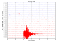
 
Magnitude Mw 5.9
Region LOMBOK REGION, INDONESIA
Date time 2018-08-09 05:25:31.9 UTC
Location 8.42 S ; 116.21 E
Depth 12 km
Distances 403 km E of Surabaya, Indonesia / pop: 2,375,000 / local time: 12:25:31.9 2018-08-09
21 km NE of Mataram, Indonesia / pop: 319,000 / local time: 13:25:31.9 2018-08-09


RO.MLR..HHZ.D.2018.221.png?1533788453859.png - Click image for larger version  Name:	RO.MLR..HHZ.D.2018.221.png?1533788453859.png Views:	1 Size:	272.1 KB ID:	2154


http://helitool.infp.ro/
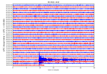
 
Magnitude Mw 5.6
Region SOUTH ATLANTIC OCEAN
Date time 2018-08-09 16:53:39.8 UTC
Location 33.47 S ; 2.49 E
Depth 10 km
Distances 1873 km SW of Windhoek, Namibia / pop: 269,000 / local time: 17:53:39.8 2018-08-09
2415 km W of Maseru, Lesotho / pop: 119,000 / local time: 18:53:39.8 2018-08-09
2474 km SW of Gaborone, Botswana / pop: 209,000 / local time: 18:53:39.8 2018-08-09

RO.MLR..HHZ.D.2018.221.png?1533821538400.png - Click image for larger version  Name:	RO.MLR..HHZ.D.2018.221.png?1533821538400.png Views:	1 Size:	396.3 KB ID:	2158

http://helitool.infp.ro/
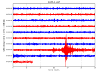
 
Magnitude mb 5.2
Region SOUTHERN MID-ATLANTIC RIDGE
Date time 2018-08-10 07:17:04.7 UTC
Location 12.83 S ; 14.63 W
Depth 10 km
Distances 2158 km S of Monrovia, Liberia / pop: 940,000 / local time: 07:17:04.7 2018-08-10
2362 km S of Freetown, Sierra Leone / pop: 803,000 / local time: 07:17:04.7 2018-08-10
2407 km SW of Yamoussoukro, Cote d'Ivoire / pop: 195,000 / local time: 07:17:04.7 2018-08-10


Magnitude mb 5.2
Region SOUTHERN MID-ATLANTIC RIDGE
Date time 2018-08-10 07:18:31.4 UTC
Location 12.87 S ; 14.64 W
Depth 10 km
Distances 2162 km S of Monrovia, Liberia / pop: 940,000 / local time: 07:18:31.4 2018-08-10
2367 km S of Freetown, Sierra Leone / pop: 803,000 / local time: 07:18:31.4 2018-08-10
2411 km SW of Yamoussoukro, Cote d'Ivoire / pop: 195,000 / local time: 07:18:31.4 2018-08-10


RO.MLR..HHZ.D.2018.222.png?1533908749293.png

http://helitool.infp.ro/
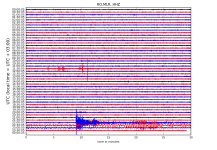
 
Magnitude Mw 5.9
Region KURIL ISLANDS
Date time 2018-08-10 18:12:07.0 UTC
Location 48.41 N ; 154.97 E
Depth 30 km
Distances 1213 km NE of Sapporo-shi, Japan / pop: 1,884,000 / local time: 03:12:07.0 2018-08-11
577 km SW of Petropavlovsk-Kamchatskiy, Russian Federation / pop: 188,000 / local time: 06:12:07.0 2018-08-11
266 km S of Severo-Kuril?sk, Russian Federation / pop: 2,500 / local time: 05:12:07.0 2018-08-11


RO.MLR..HHZ.D.2018.222.png?1533908749293.png - Click image for larger version  Name:	RO.MLR..HHZ.D.2018.222.png?1533908749293.png Views:	1 Size:	380.0 KB ID:	2170


http://helitool.infp.ro/
 
Magnitude Mw 5.1
Region ALBANIA
Date time 2018-08-11 15:38:34.0 UTC
Location 41.59 N ; 20.21 E
Depth 10 km
Distances 44 km NE of Tirana, Albania / pop: 375,000 / local time: 17:38:34.0 2018-08-11
21 km SW of Peshkopi, Albania / pop: 14,900 / local time: 17:38:34.0 2018-08-11
11 km N of Bulqiz?, Albania / pop: 11,300 / local time: 17:38:34.0 2018-08-11

RO.MLR..HHZ.D.2018.223.png?1534004506055.png - Click image for larger version  Name:	RO.MLR..HHZ.D.2018.223.png?1534004506055.png Views:	1 Size:	296.3 KB ID:	2182


http://helitool.infp.ro/
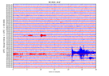
 
Magnitude Mw 6.4
Region NORTHERN ALASKA
Date time 2018-08-12 14:58:54.7 UTC
Location 69.62 N ; 145.25 W
Depth 10 km
Distances 2560 km N of Vancouver, Canada / pop: 1,838,000 / local time: 07:58:54.7 2018-08-12
469 km E of Barrow, United States / pop: 4,300 / local time: 06:58:54.7 2018-08-12
138 km SE of Prudhoe Bay, United States / pop: 2,200 / local time: 06:58:54.7 2018-08-12

RO.MLR..HHZ.D.2018.224.png?1534056522660.png


http://helitool.infp.ro/
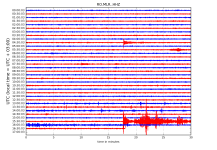
 
Magnitude Mw 6.1
Region SOUTH SANDWICH ISLANDS REGION
Date time 2018-08-14 03:29:52.4 UTC
Location 58.17 S ; 25.34 W
Depth 30 km
Distances 3452 km SE of Montevideo, Uruguay / pop: 1,271,000 / local time: 00:29:52.4 2018-08-14
3581 km SE of Buenos Aires, Argentina / pop: 13,077,000 / local time: 00:29:52.4 2018-08-14
4336 km SE of Santiago, Chile / pop: 4,838,000 / local time: 00:29:52.4 2018-08-14


RO.MLR..HHZ.D.2018.226.png?1534220968778.png - Click image for larger version  Name:	RO.MLR..HHZ.D.2018.226.png?1534220968778.png Views:	1 Size:	168.2 KB ID:	2205

http://helitool.infp.ro/
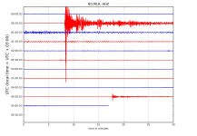
 
Magnitude Mw 6.6
Region ANDREANOF ISLANDS, ALEUTIAN IS.
Date time 2018-08-15 21:56:57.1 UTC
Location 51.51 N ; 178.04 W
Depth 40 km
Distances 3769 km NE of Tokyo, Japan / pop: 8,337,000 / local time: 06:56:57.1 2018-08-16
4500 km NE of Pyongyang, Korea, Democratic People's Republic of / pop: 3,222,000 / local time: 06:26:57.1 2018-08-16
4515 km NE of Seoul, Korea, Republic of / pop: 10,350,000 / local time: 06:56:57.1 2018-08-16


RO.MLR..HHZ.D.2018.227.png?1534439608220.png


http://helitool.infp.ro/
 
Magnitude Mw 5.3
Region SOUTHERN ITALY
Date time 2018-08-16 18:19:06.1 UTC
Location 41.89 N ; 14.82 E
Depth 10 km
Distances 194 km E of Roma, Italy / pop: 2,564,000 / local time: 20:19:06.1 2018-08-16
39 km N of Campobasso, Italy / pop: 50,800 / local time: 20:19:06.1 2018-08-16

Magnitude Mw 6.3
Region VOLCANO ISLANDS, JAPAN REGION
Date time 2018-08-16 18:21:31.9 UTC
Location 23.39 N ; 143.40 E
Depth 15 km
Distances 938 km N of Saipan, Northern Mariana Islands / pop: 48,300 / local time: 04:21:31.9 2018-08-17
1410 km S of Tokyo, Japan / pop: 8,337,000 / local time: 03:21:31.9 2018-08-17
2220 km SE of Seoul, Korea, Republic of / pop: 10,350,000 / local time: 03:21:31.9 2018-08-17


wAAACH5BAEKAAAALAAAAAABAAEAAAICRAEAOw==
?

RO.MLR..HHZ.D.2018.228.png?1534440287277.png


http://helitool.infp.ro/
 
Magnitude Mw 6.5
Region FLORES SEA
Date time 2018-08-17 15:35:02.3 UTC
Location 7.36 S ; 119.81 E
Depth 546 km
Distances 249 km S of Makassar, Indonesia / pop: 1,322,000 / local time: 23:35:02.3 2018-08-17
140 km N of Komodo, Indonesia / pop: 2,000 / local time: 23:35:02.3 2018-08-17


RO.MLR..HHZ.D.2018.229.png?1534524686643.png

http://helitool.infp.ro/
 
Magnitude Mw 8.2
Region FIJI REGION
Date time 2018-08-19 00:19:37.3 UTC
Location 18.13 S ; 178.14 W
Depth 558 km
Distances 362 km E of Suva, Fiji / pop: 77,400 / local time: 12:19:37.3 2018-08-19
324 km SE of Lambasa, Fiji / pop: 24,200 / local time: 12:19:37.3 2018-08-19


Magnitude Mw 6.8
Region FIJI REGION
Date time 2018-08-19 04:28:58.7 UTC
Location 17.03 S ; 178.04 W
Depth 420 km
Distances 393 km E of Suva, Fiji / pop: 77,400 / local time: 16:28:58.7 2018-08-19
283 km E of Lambasa, Fiji / pop: 24,200 / local time: 16:28:58.7 2018-08-19

RO.MLR..HHZ.D.2018.231.png?1534655863363.png


http://helitool.infp.ro/
 
'' Magnitude Mw 8.2
Region FIJI REGION
Date time 2018-08-19 00:19:37.3 UTC
Location 18.13 S ; 178.14 W
Depth 558 km
Distances 362 km E of Suva, Fiji / pop: 77,400 / local time: 12:19:37.3 2018-08-19
324 km SE of Lambasa, Fiji / pop: 24,200 / local time: 12:19:37.3 2018-08-19 ''

https://youtu.be/Yh4rzvSKBbE
 
Back
Sus